adventure geology

Breakfast in the Sierras

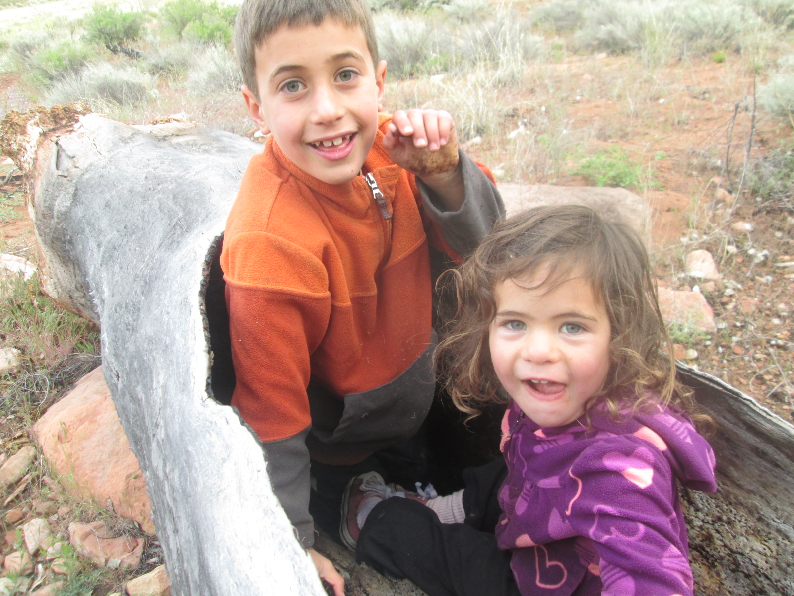
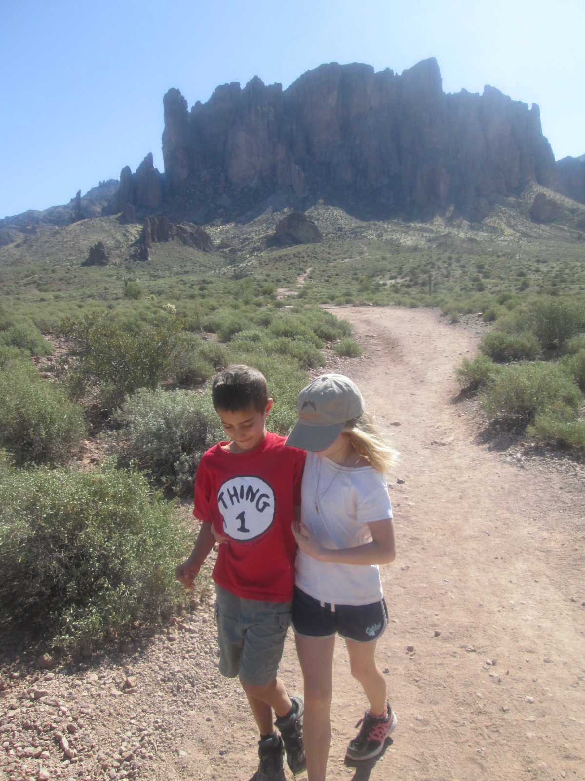
“Hey Jacob you ready?” Elias yells enthusiastically

“Yea, let’s go!” Jacob answers.

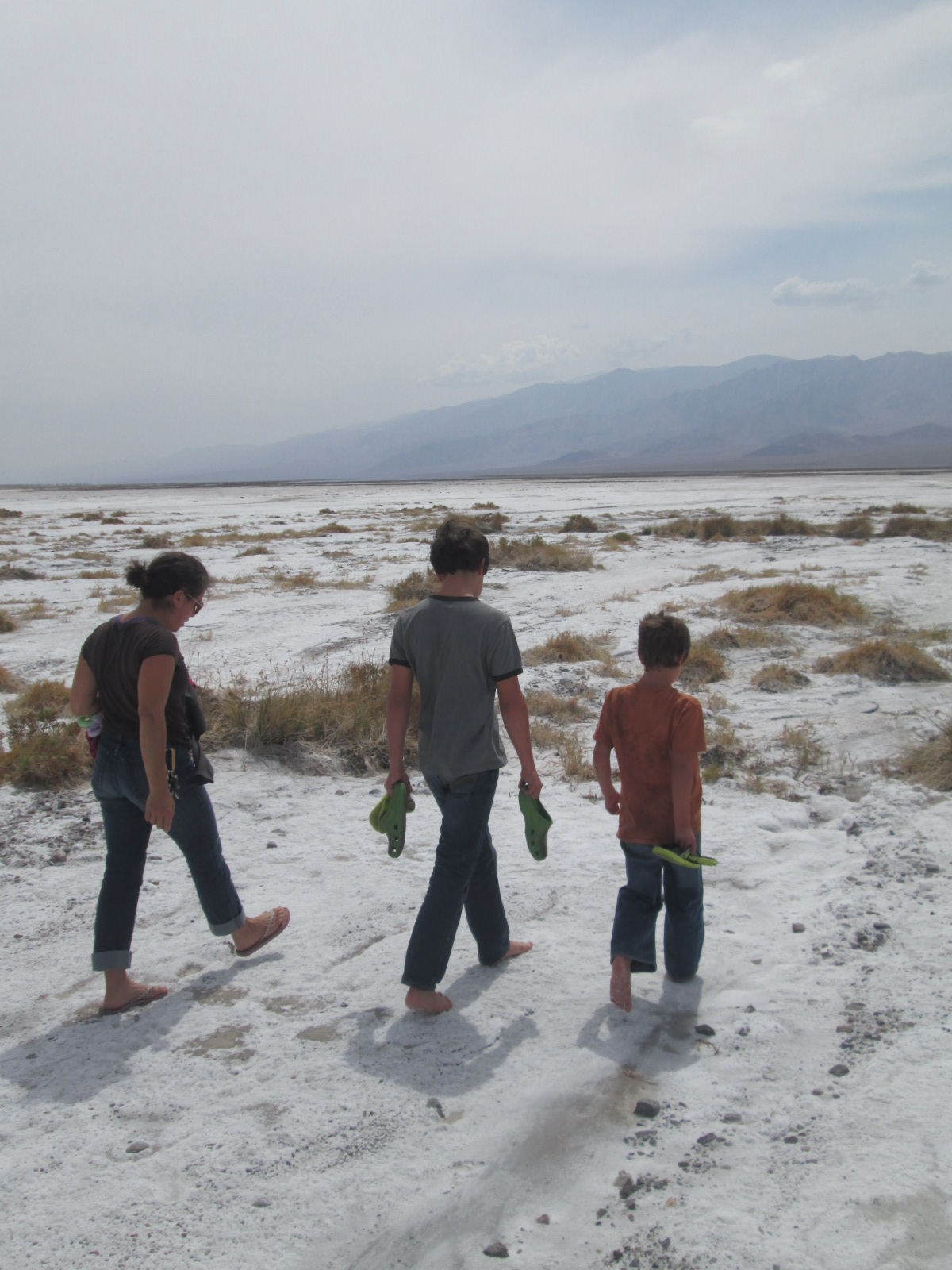
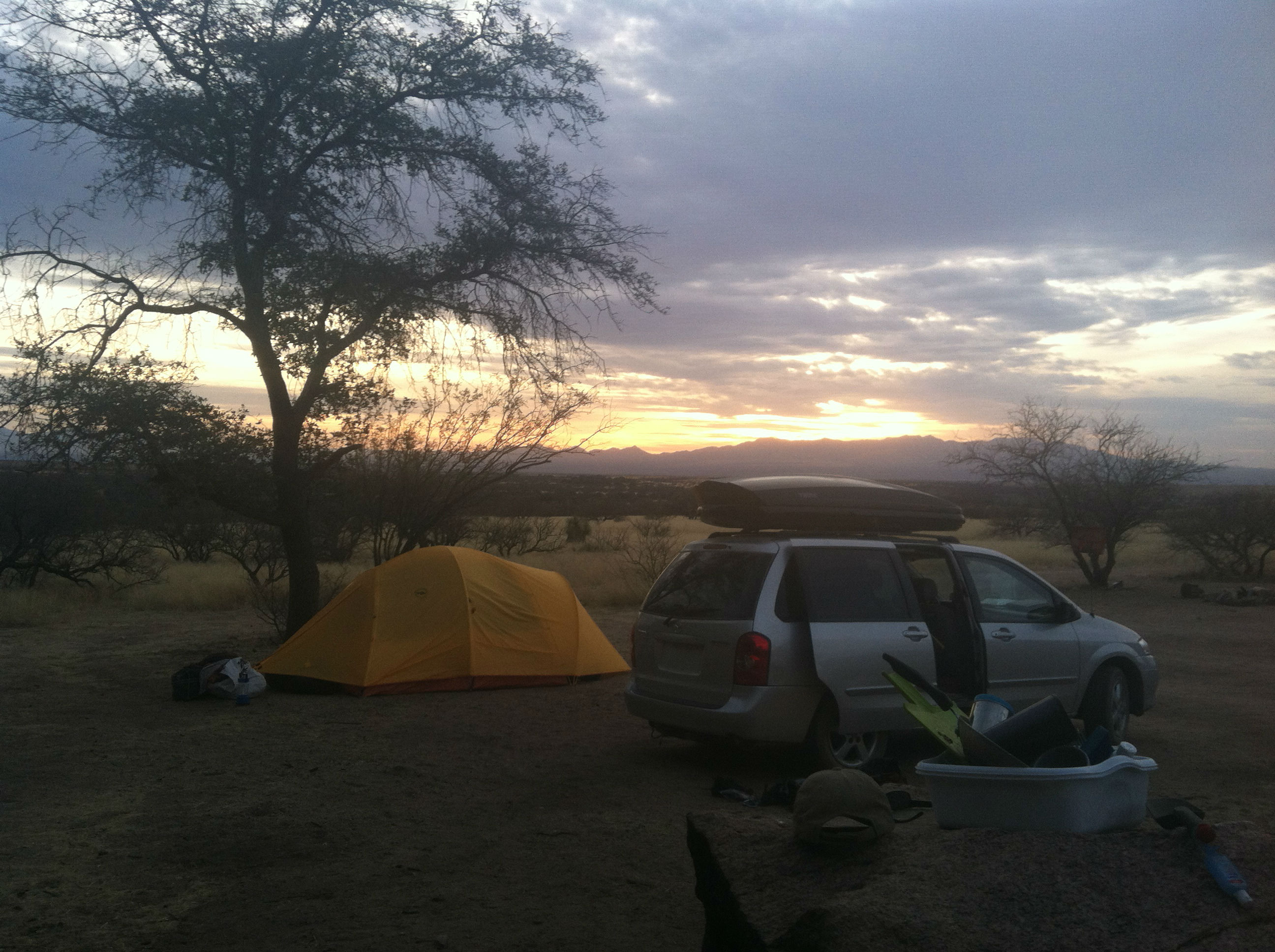
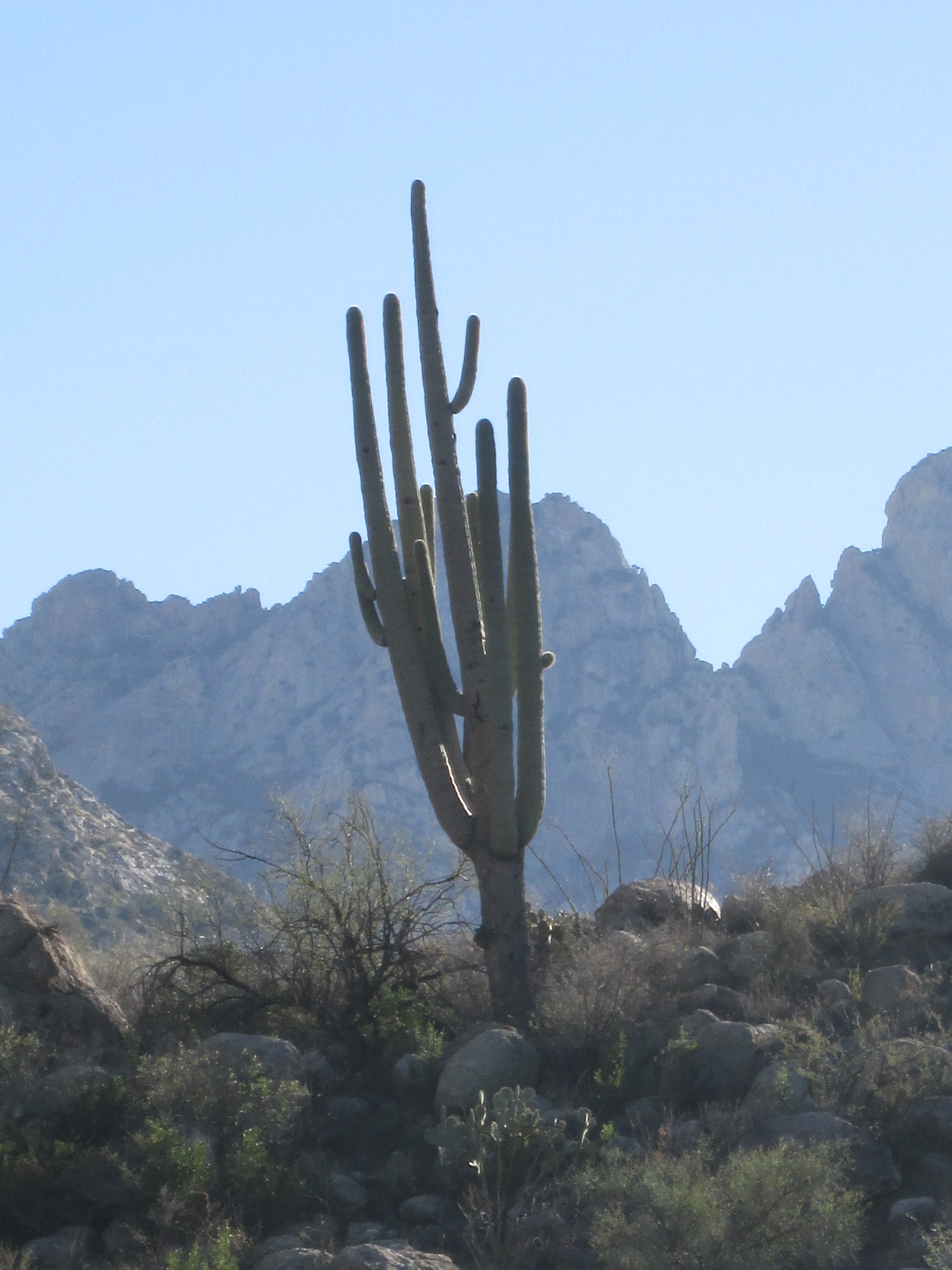
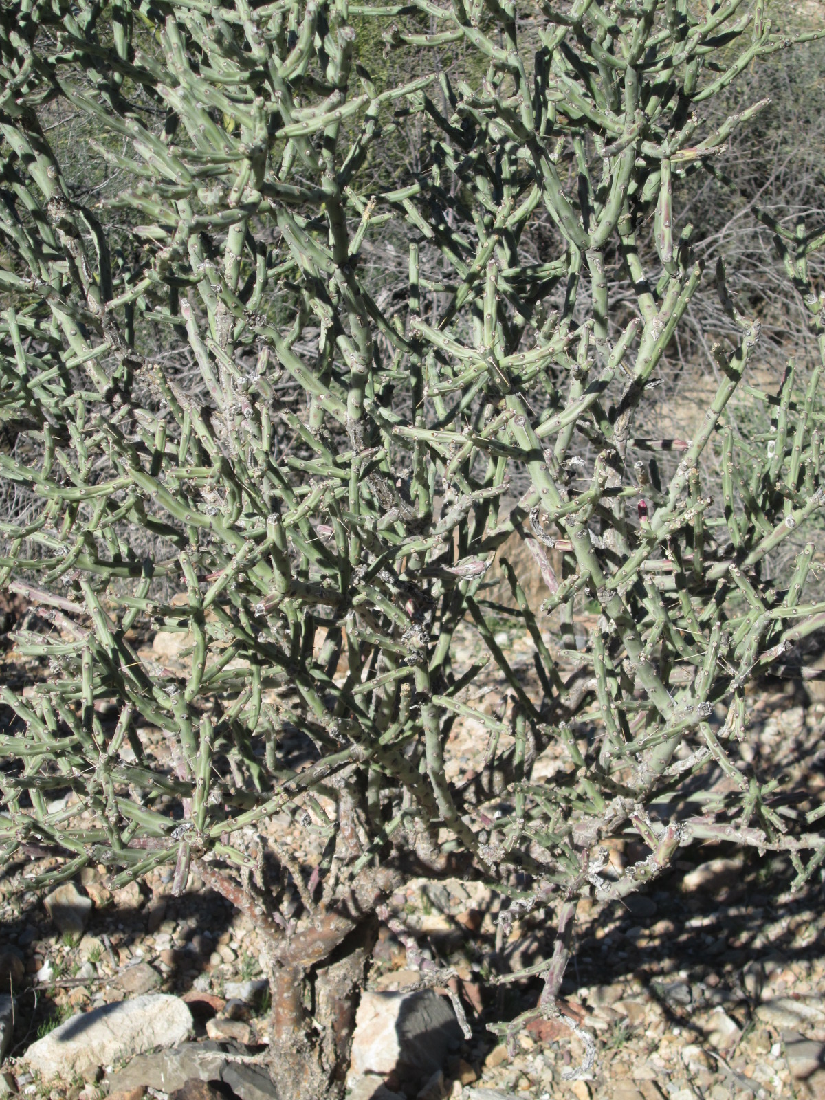
Through the sound of a rushing creek I slowly awoke realizing the boys were off again on another adventure. My mind stirred and I remembered drifting to sleep the night before while watching Ila and Michelle’s eyes reflecting the bright white light of infinite stars above. I stretch big but not to disturb the girls since they’re still dreaming of stars, put on my blue shorts my blue T-shirt and greet the big sloping sage brush plain and the Sierra’s, aaaah, heaven.

“Coffee is ready hun!” I say after I hear Michelle starting to stir.
Both burners on the trusted Coleman stove are frying breakfast now. Michelle and I sip coffee together and deeply enjoy discussing nothing important.

IMG_3155

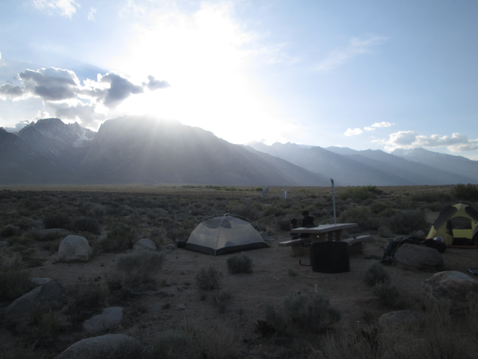
“I guess Ben is down in Prescott by now” I say. I am reflecting on the first day we arrived here – four days ago. We met up with Ben and Ruth, our friends who recently moved from Prescott to Mammoth Lakes, two hours to the North. Together we went on a hike after connecting that morning, up sage brush slopes with snow capped peaks towering way above. Big horn sheep ran on distant hillsides and wild flowers were in bloom as we hiked up a trail with no goal other than catching up. Ila attached their dogs leash to Ben coaxing him down the trail. We shared dinner, drinks, stories and soccer that night.

IMG_3173 IMG_3169 Ruth in camp

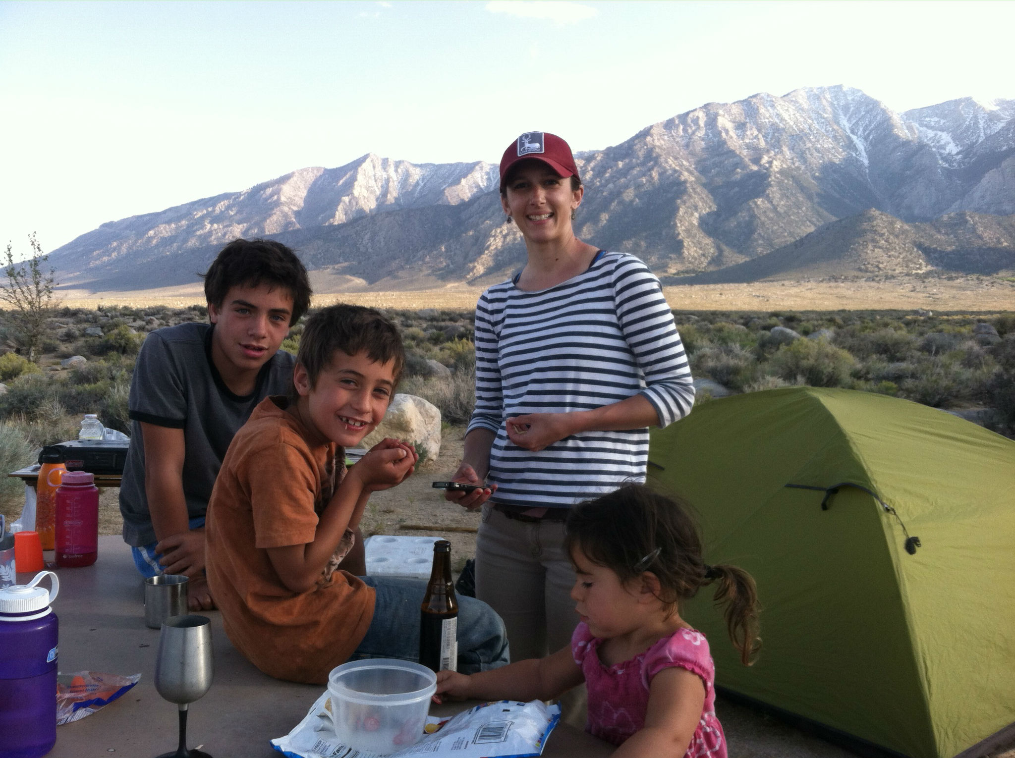
“Pancakes and eggs are ready” I yell loud enough to make sure the boys can hear  as they play out in the sage near the creek. Do they really need to come now? No, Michelle and I can enjoy breakfast quietly, they’ll eat later.  They pretend they didn’t hear me regardless and keep playing.

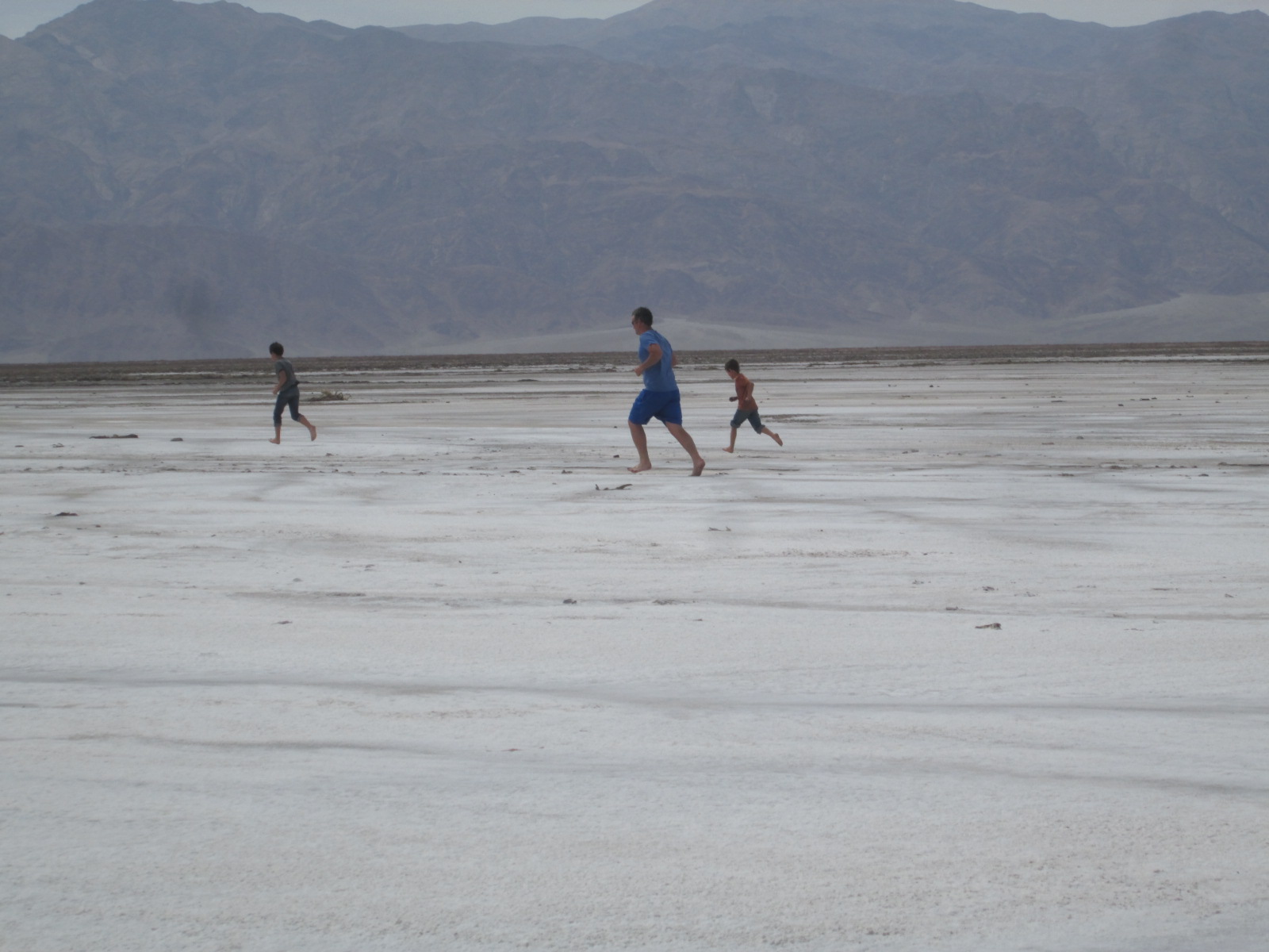
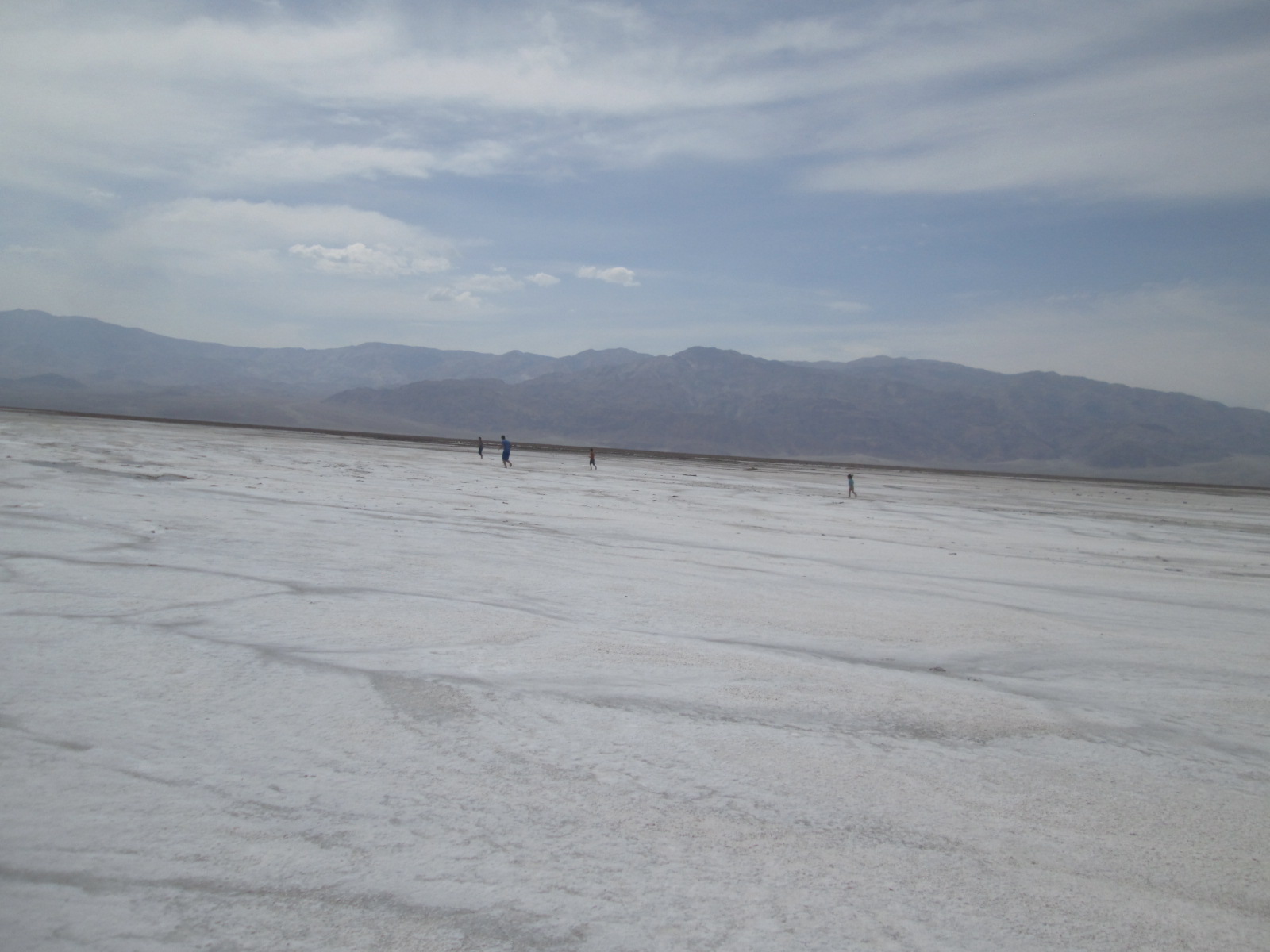
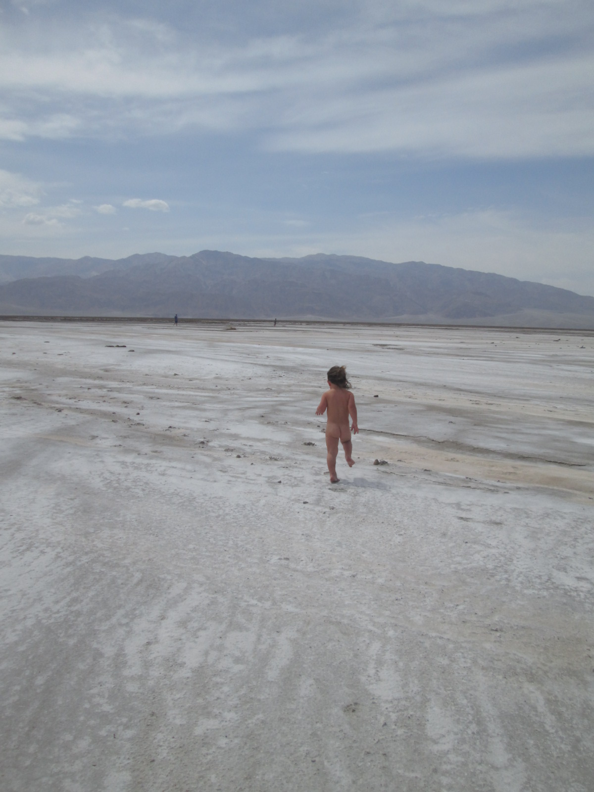
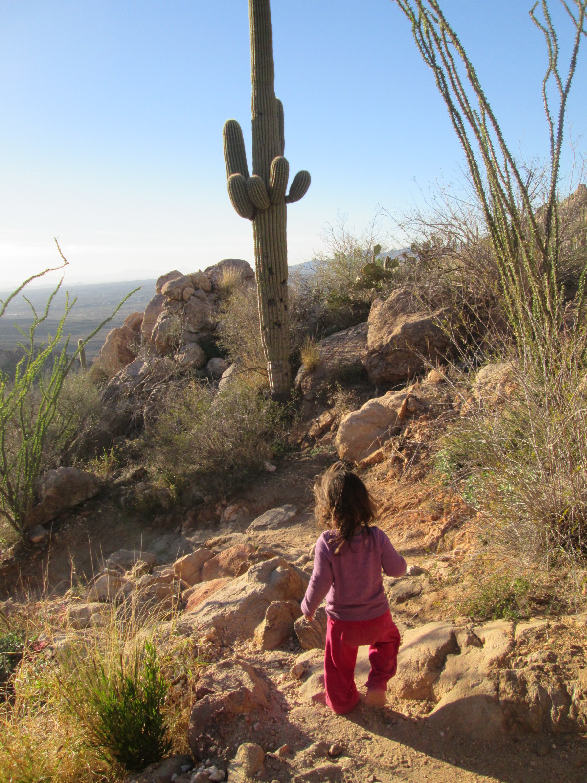
This is more or less how we greeted the last five days, completely surrendered to the comfortable and spectacular scenery. Every morning soaking it up, letting it inspire us all over again and then diving into the next adventure.

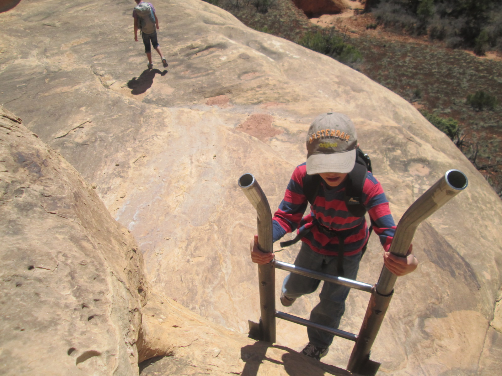
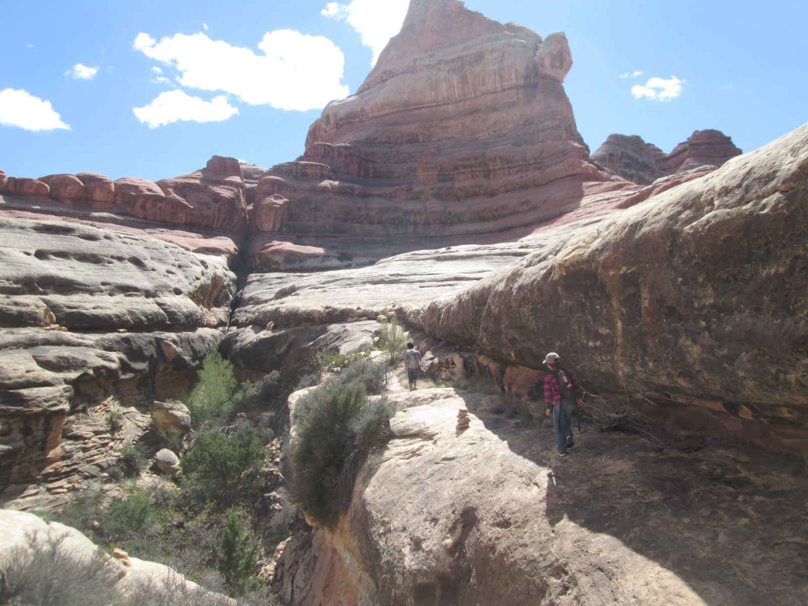
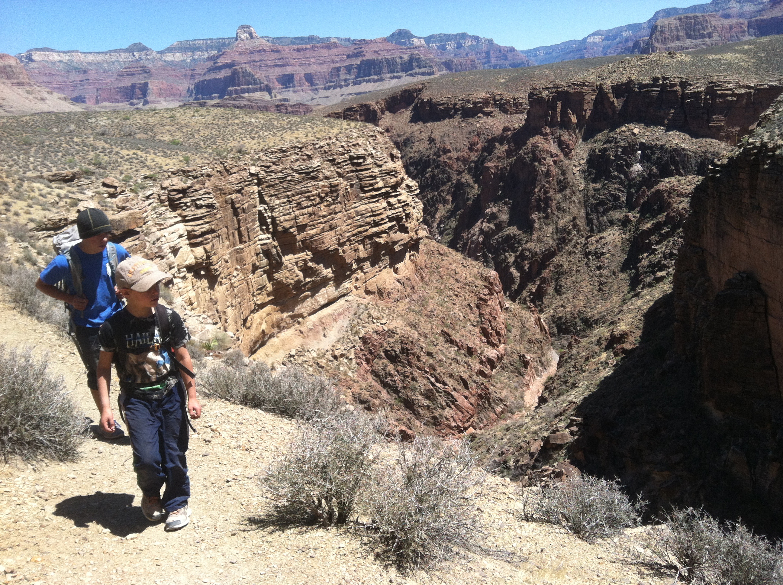
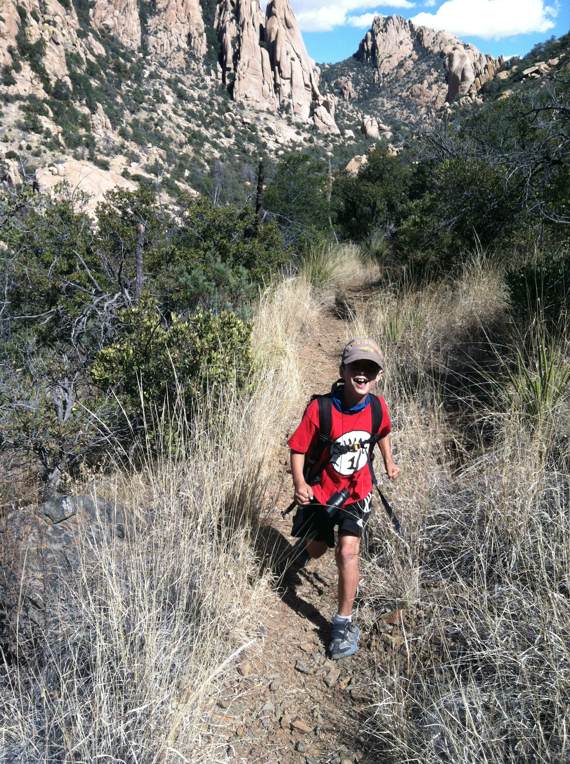
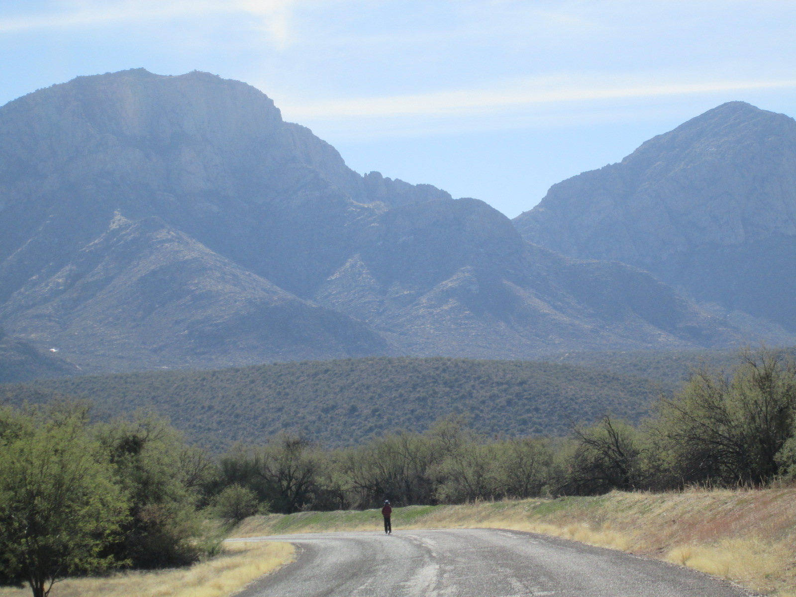
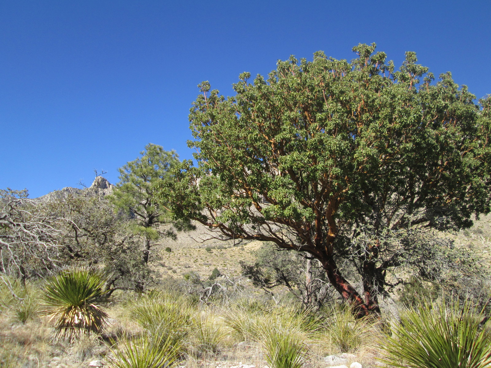
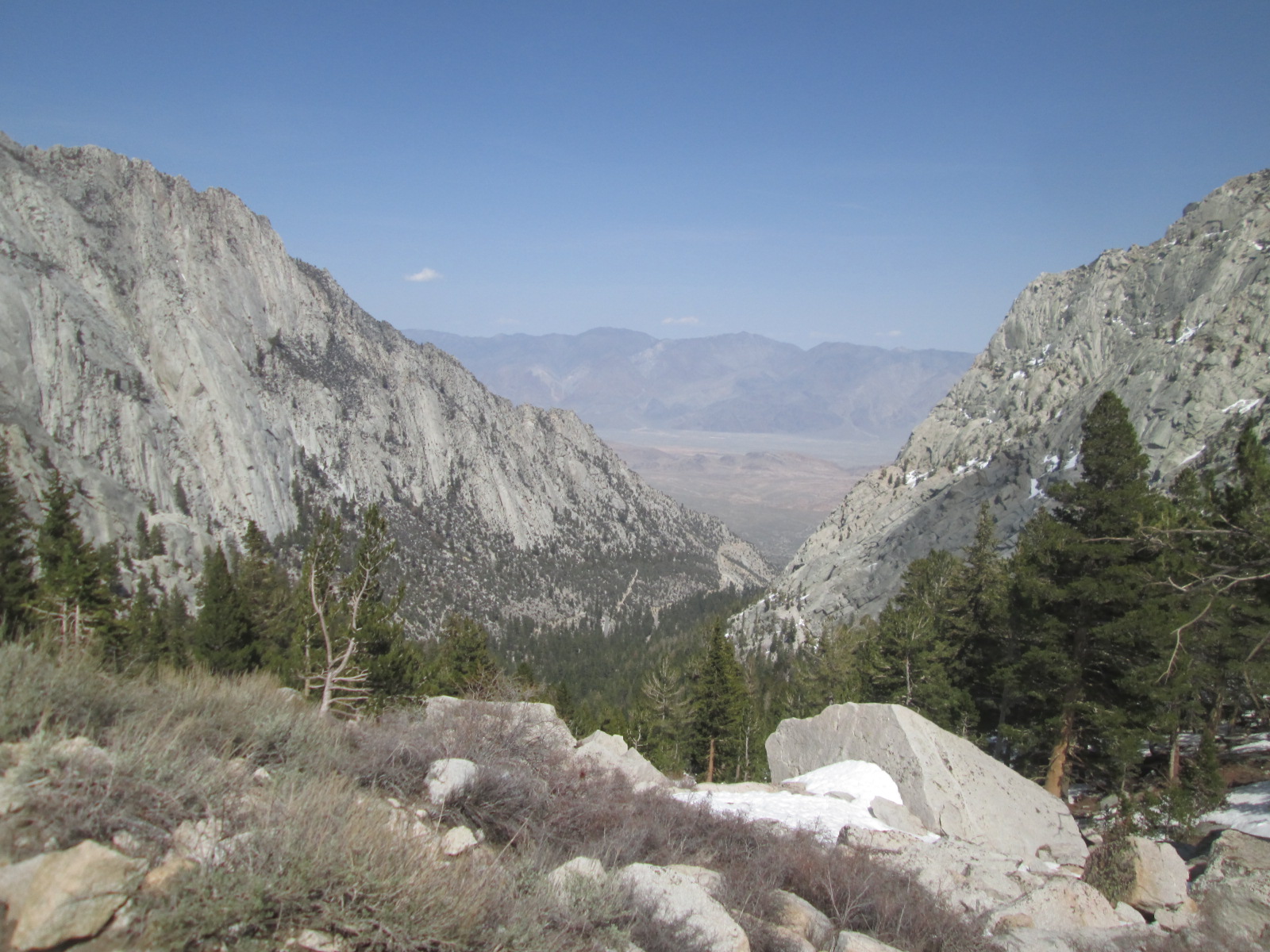
On our third day here, we went up to the great craggy and snowy mountains that stand high above camp. Mount Whitney is the tallest of these peaks. It sits at just around fourteen and a half thousand feet in elevation higher than all of the mountain in the contiguous US. Although the mountains are high and craggy, this year they remained snow free for over 2,000 feet of our hike taking us to over 10,000 feet of elevation into the snow. Jacob and Elias were entranced by the seriousness of the mountains as they ran way ahead up the dry trails, telling each other stories. Michelle and I tried to keep up with Ila. Living in the desert for weeks without big mountain strolles made this hike all the more appealing.

“What a beautiful hike that was” I say while flipping one of the classic pancakes I’ve been making on a regular basis since we left Bellingham last year – about 4 inches in diameter and cooked deeply in butter. Not complete without eggs and really nothing is better when you’re hungry.

“Super fun,” Michelle agrees. “Still not enough to wear out the boys though,”  she adds.

It’s true that over the last month we’ve noticed a big jump in their fitness.  The way they were jogging up those switch backs was an incredible affirmation that this year of athletic family adventure is above and beyond what they would ever receive during a conventional year at home.  The mental and physical health benefits will reverberate through their entire lives.


IMG_3198  IMG_3189 IMG_3178 IMG_3176

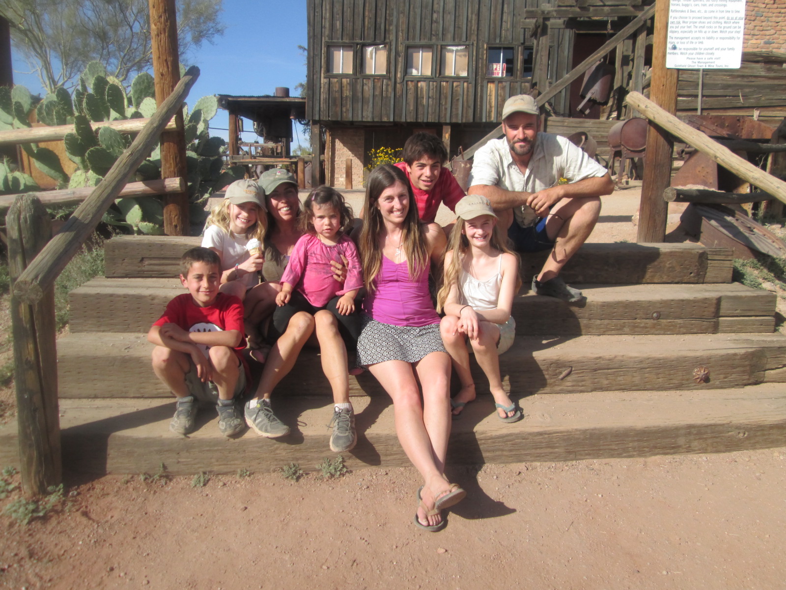
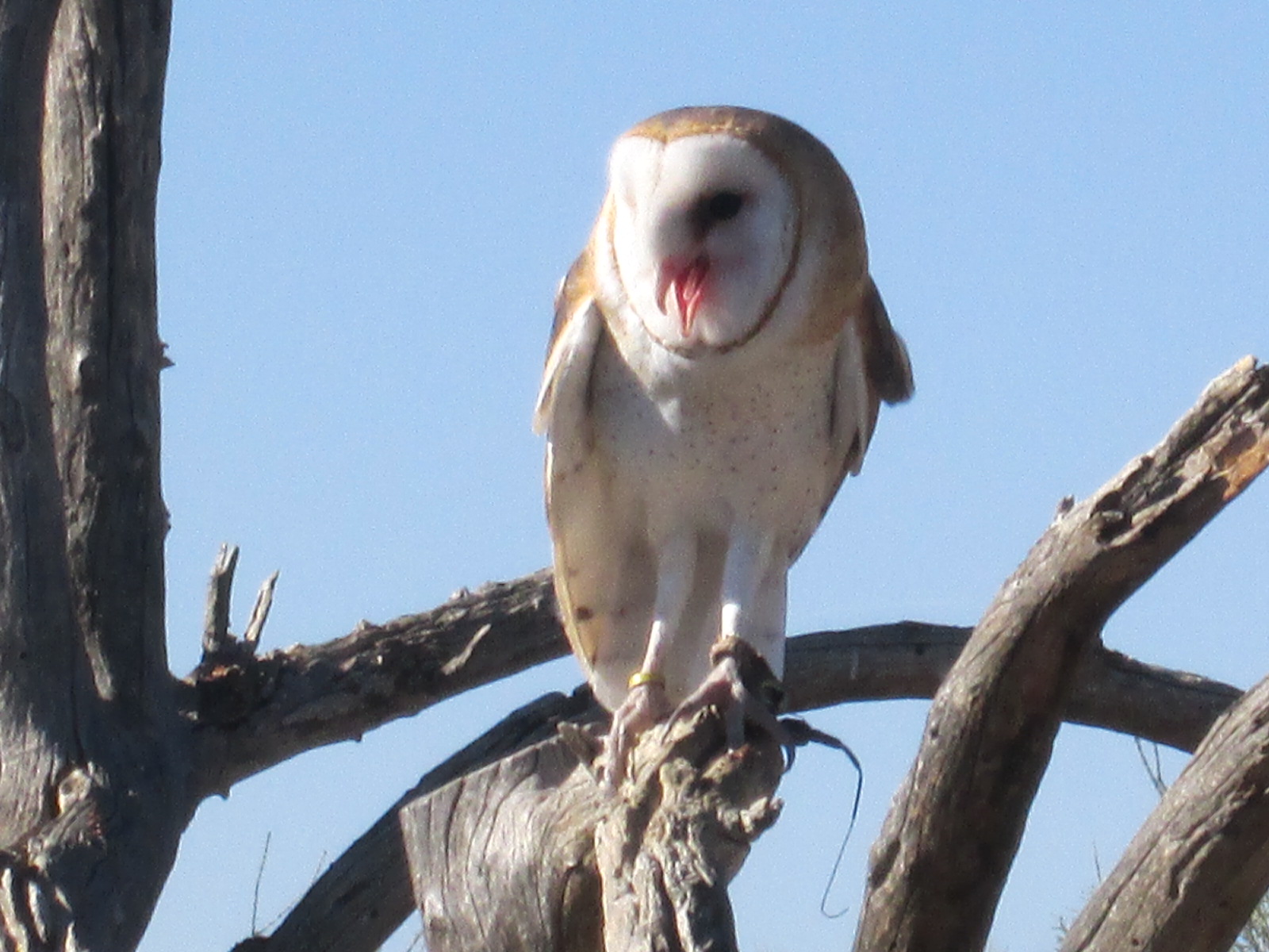
On the second morning I woke up to Jacob and Elias going on their morning adventure but this time it sounded like the adventure was taking place closer by.   A rush of panic hit me as I remembered it was Easter Sunday. “Darn – did the Easter Bunny do its job” I thought to myself.  Ahhh… I remembered that yes indeed, the Easter Bunny did do its job….almost. In the end it mistakenly gave Ila, Jacob’s treats and Jacob, Ila’s treat but I decide to forgive the bunny this time. I imagine the delivery rabbit was a cousin of the Easter Bunny anyway, the Desert Long Eared Jack Rabbit. Regardless, the boys found chocolates eggs, rabbits and other delights throughout the sage brush that morning. They also woke up to a basket stuffed full of treasures and dutifully helped their sister discover the magic as well.

“I wish we could stay here forever.” I say

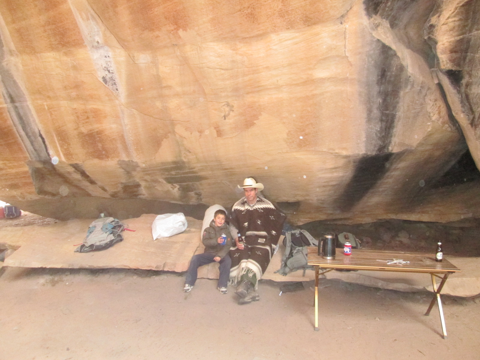
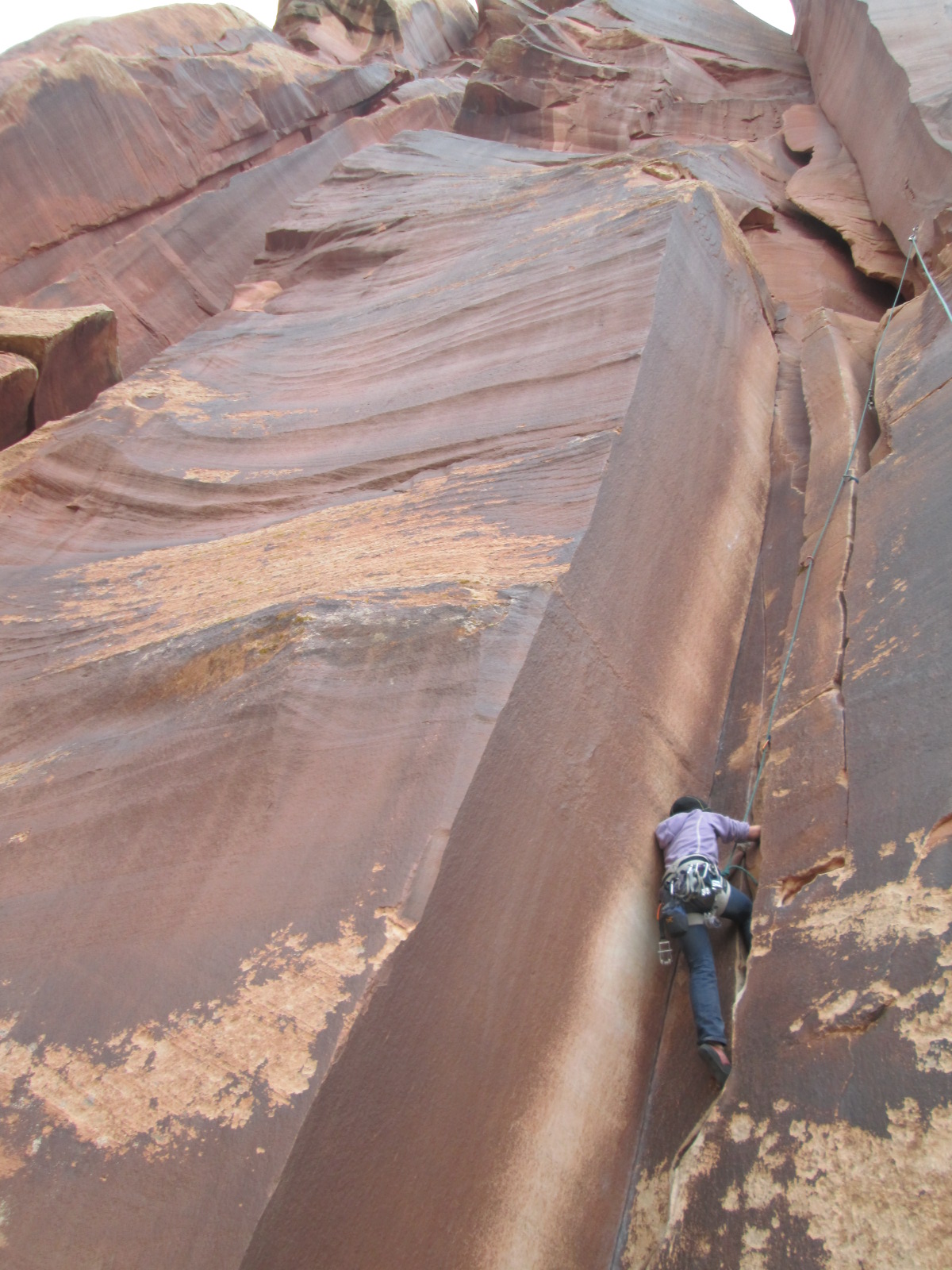
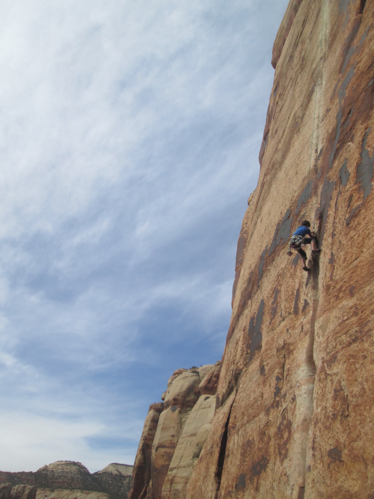
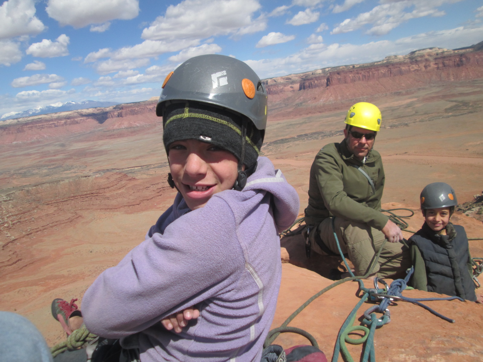
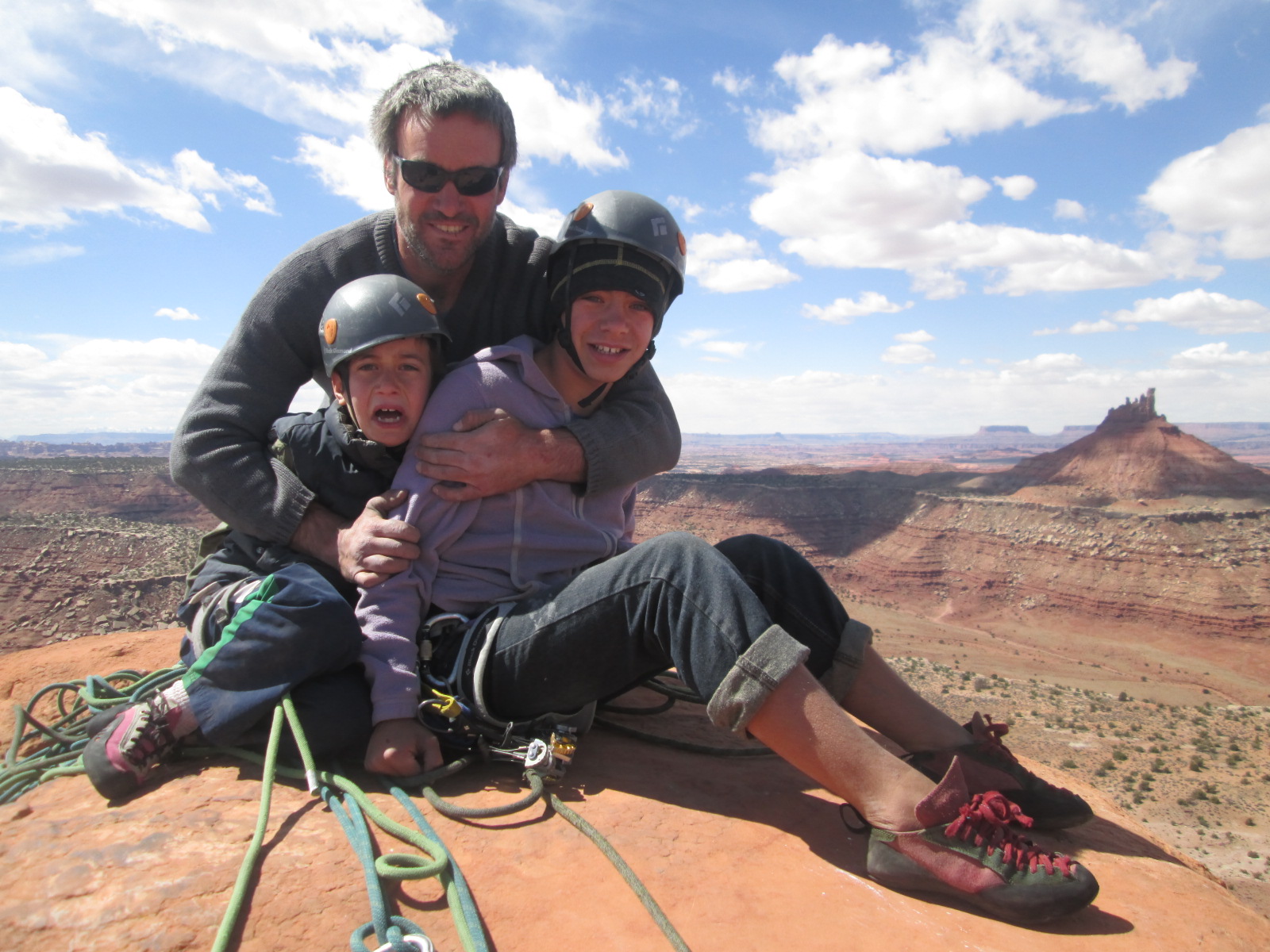
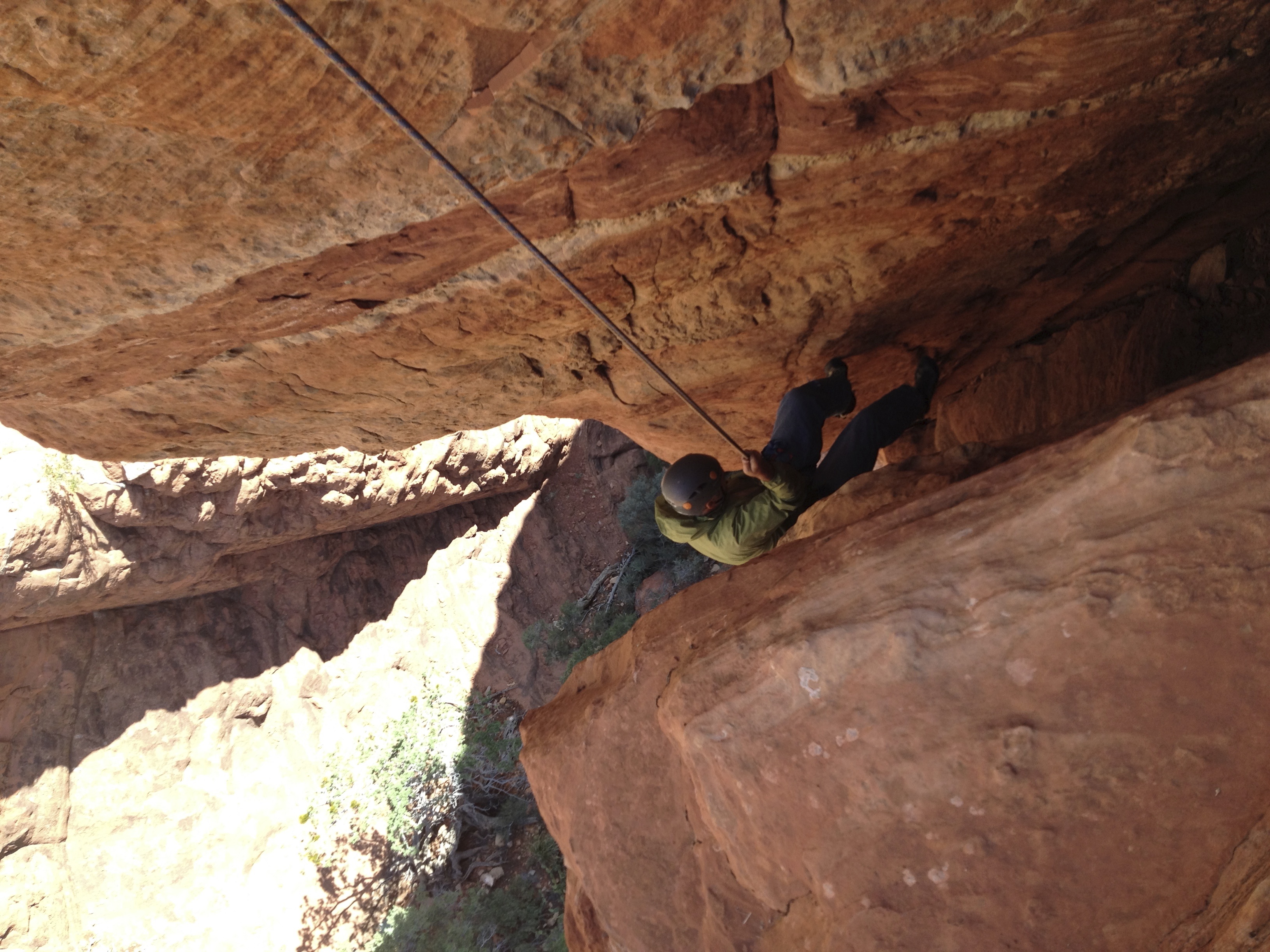
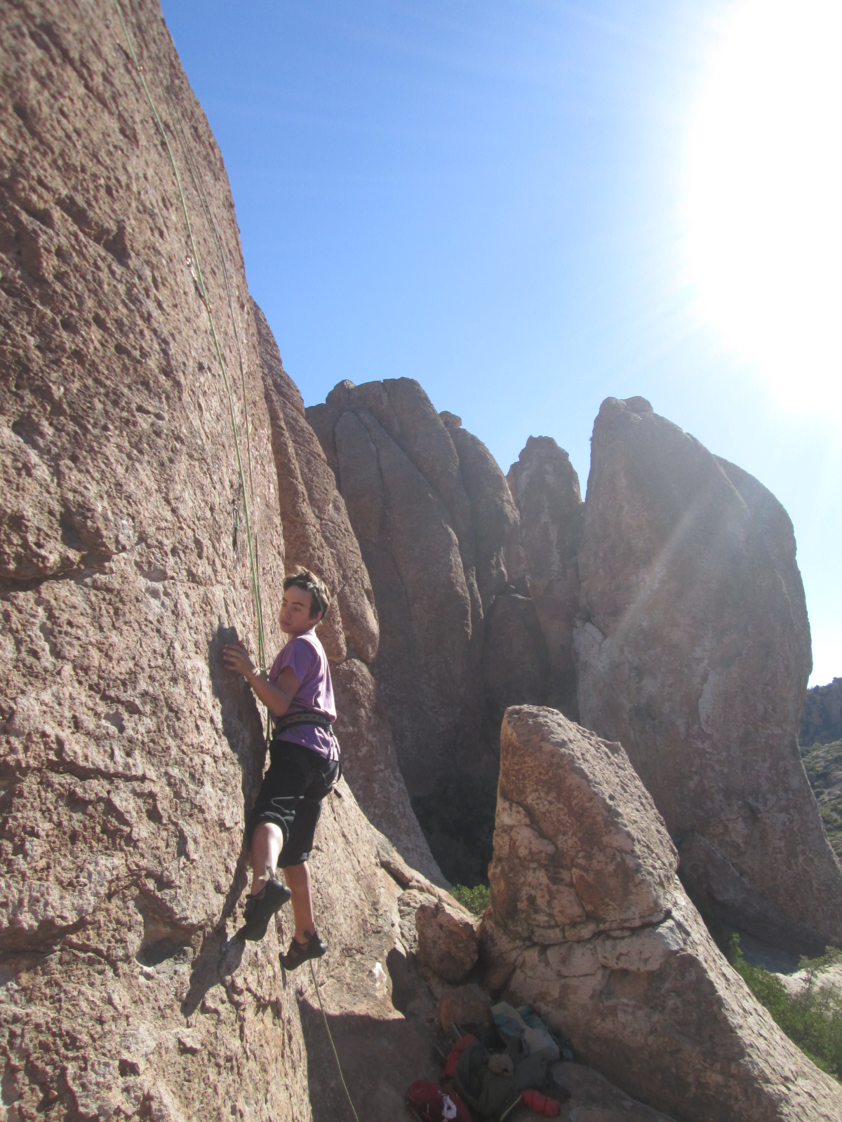
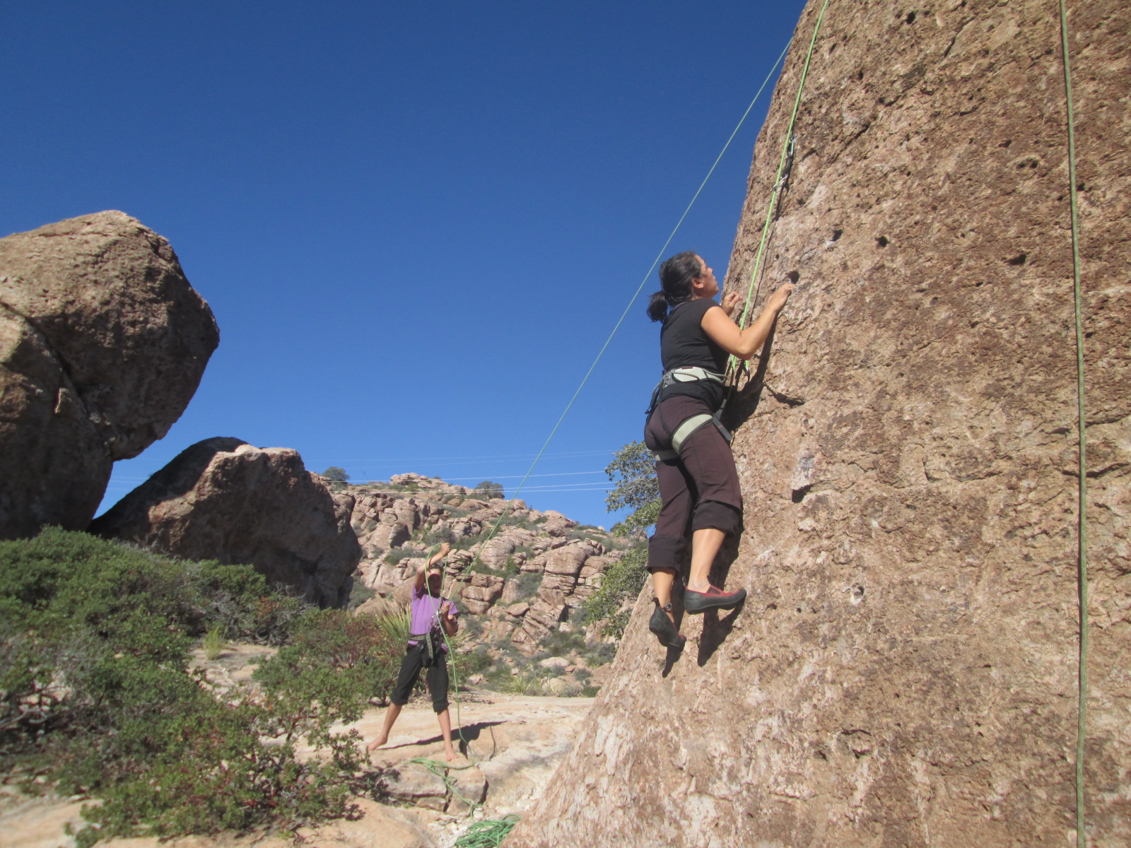
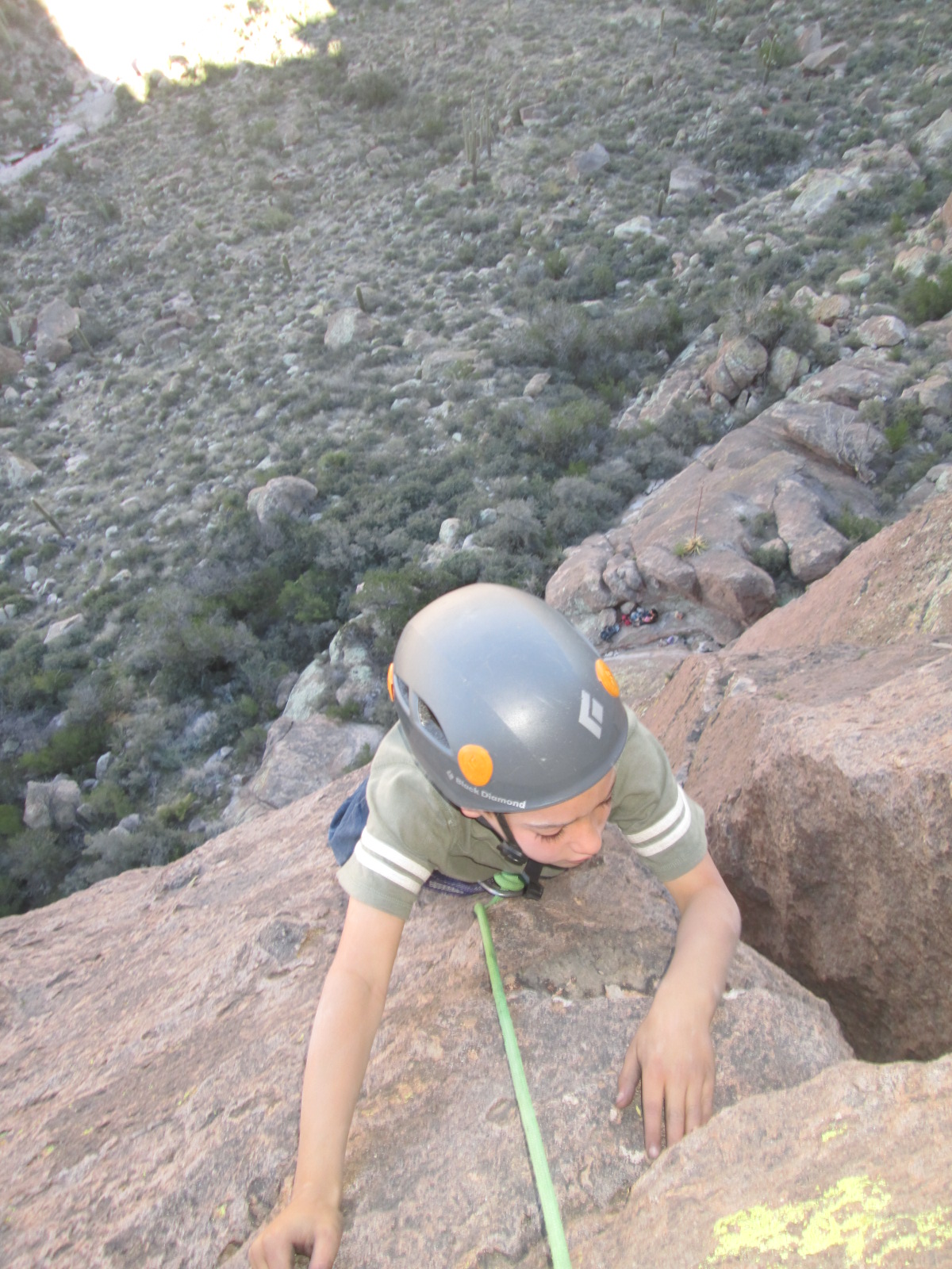
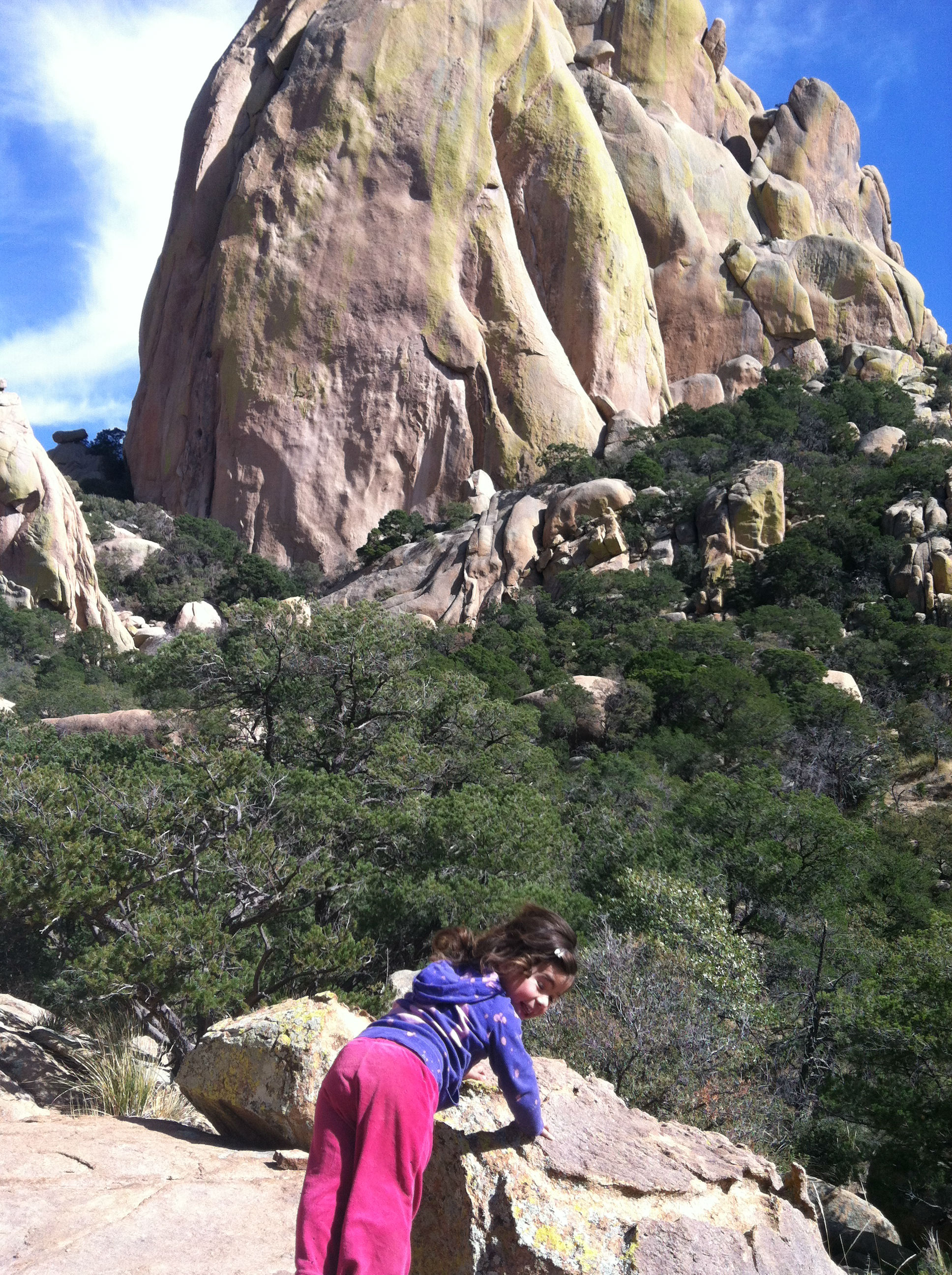
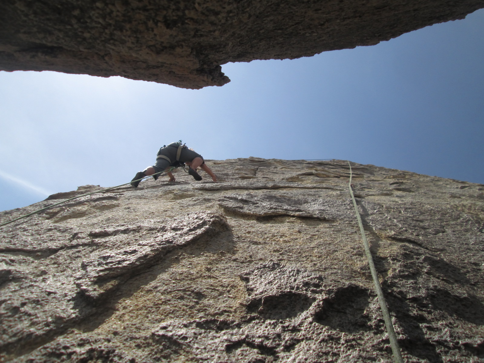
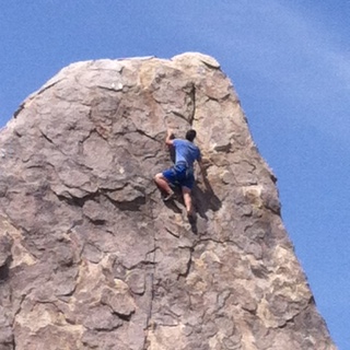
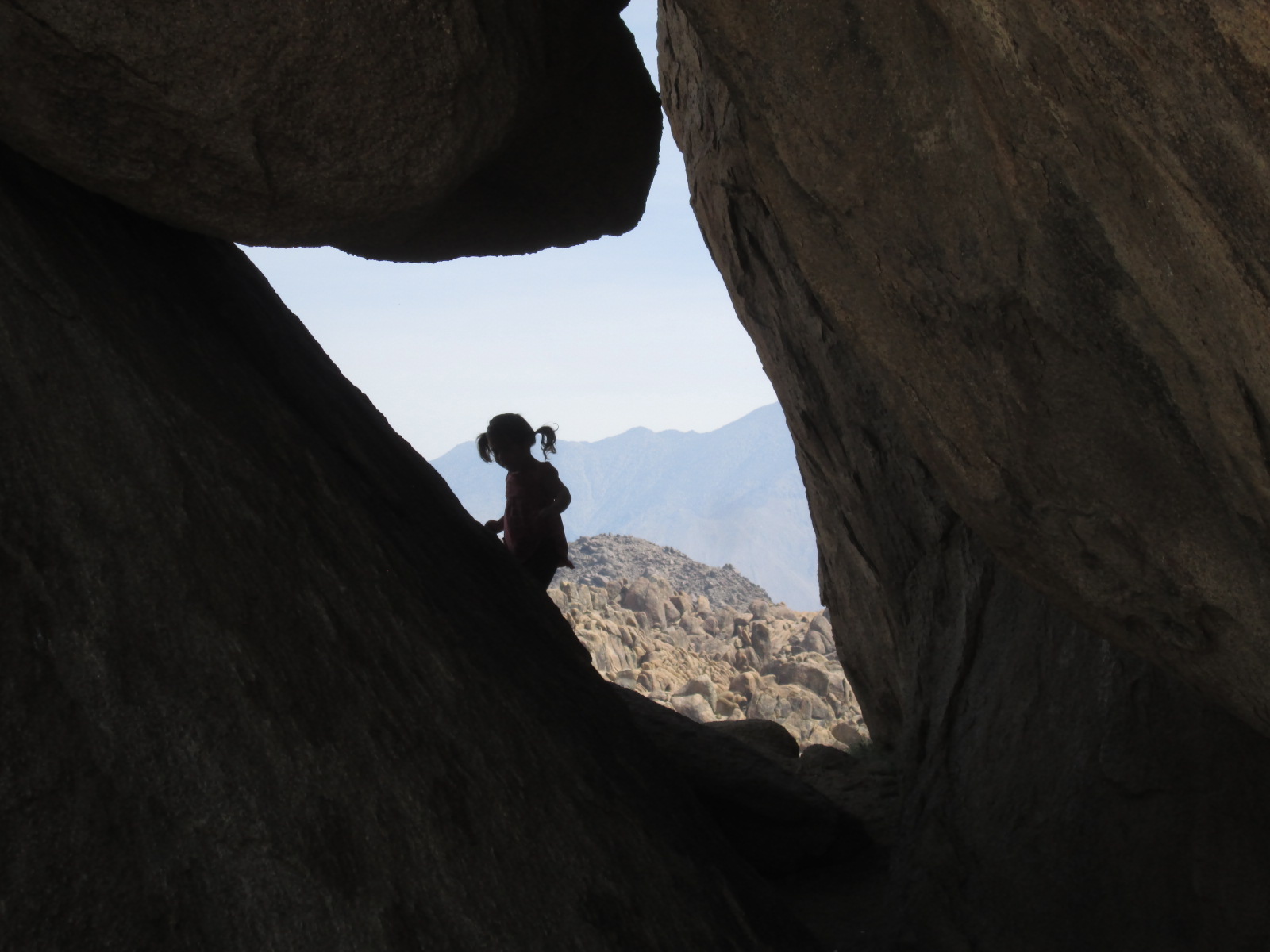
Michelle knowing what I loved most of all agreed, “We should just load up one of those rocks in to our roof rack and take it with us.” She was talking about yesterday when we went rock climbing!

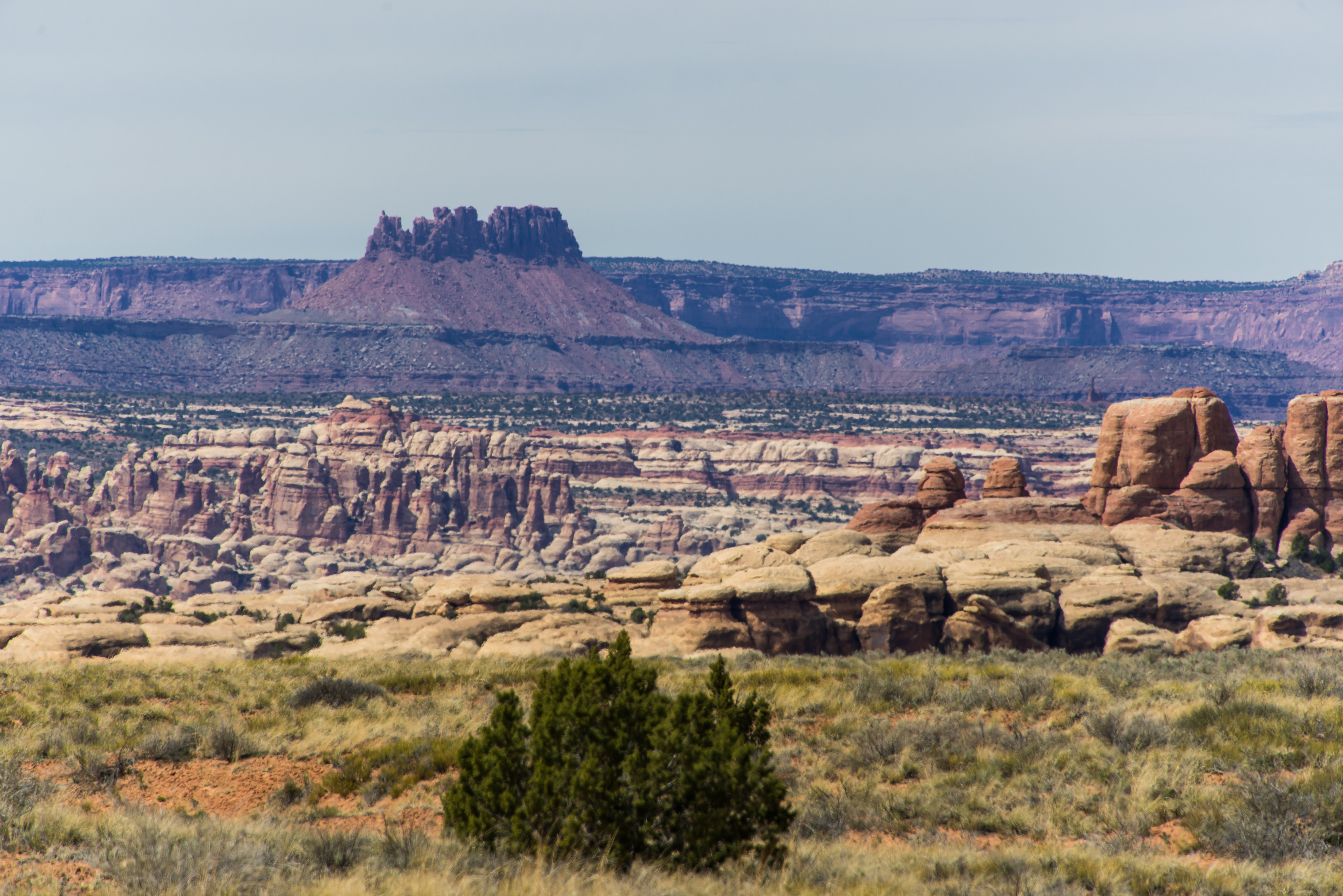
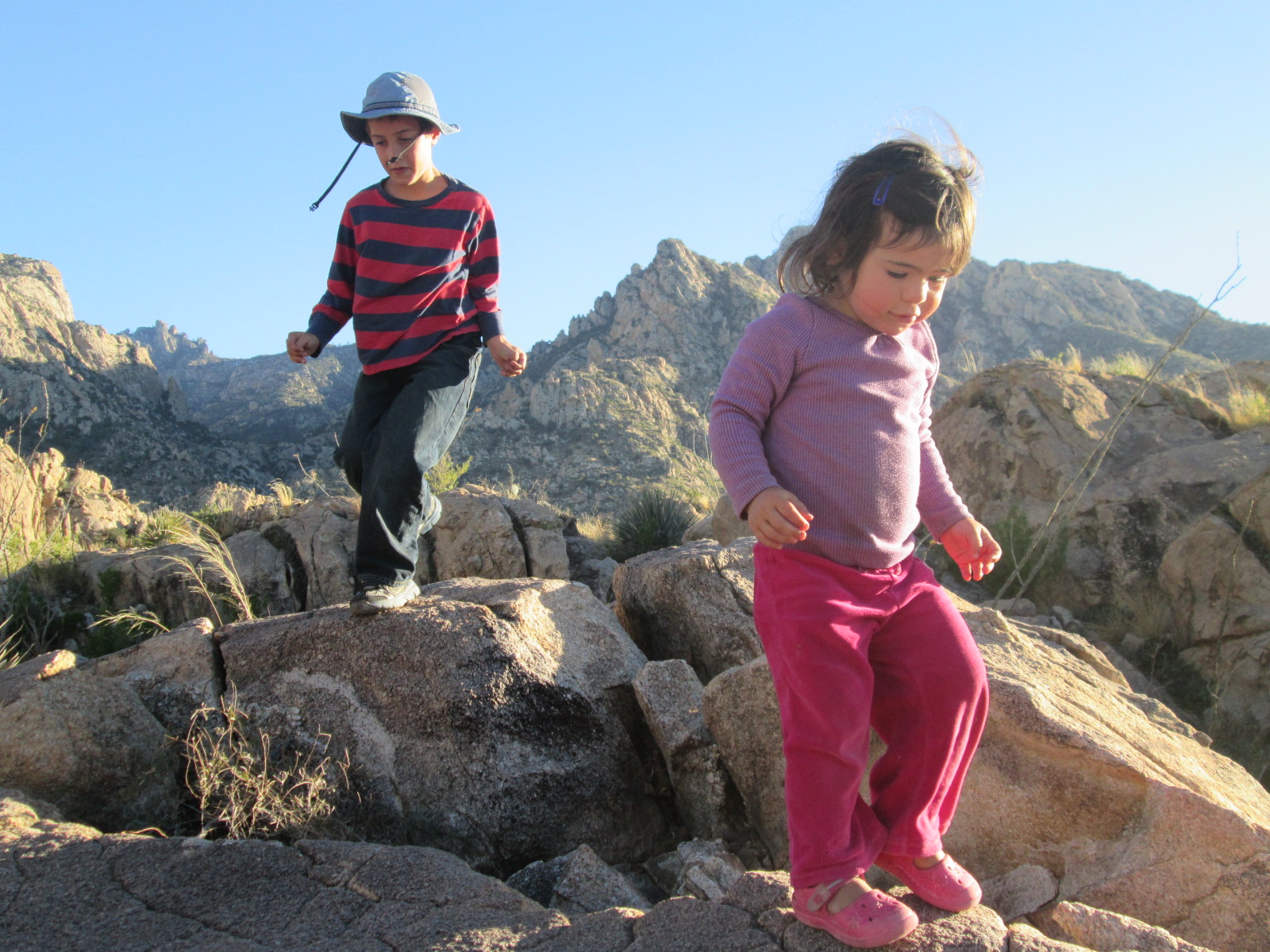
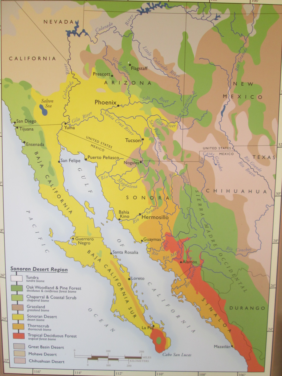
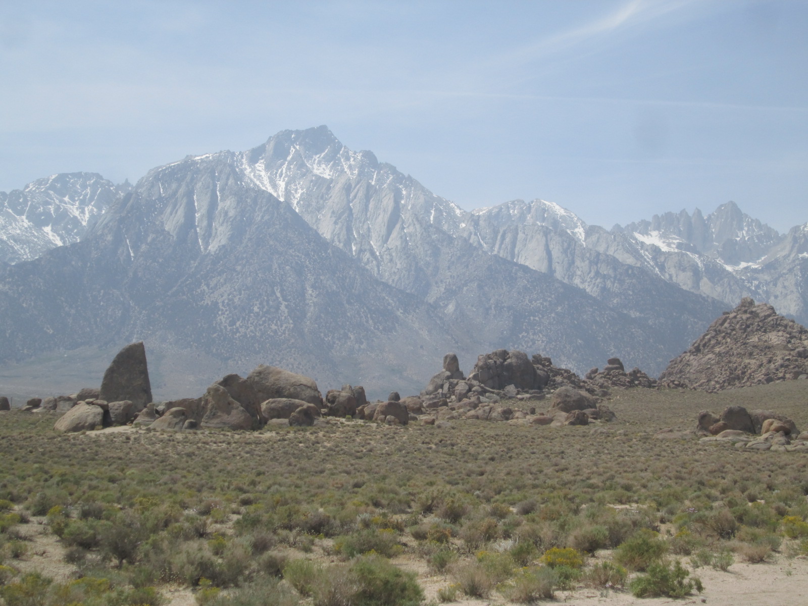
The basin that we are camped above is not just a sage brush plain but just below us there is a series of craggy broken hills called the Alabama Hills. The famous granite outcrops with a spell binding mountain back drop has been viewed by millions of people throughout the world as a classic western scene for dozens of big Hollywood productions. The gritty granite usually tops out on super cool 40 to 100 foot block of granite. The landscape of rocky climbs has no defined end to it.

IMG_3206 IMG_3212 IMG_3217 IMG_3209 photo 4(1)photo 3(2)IMG_3205 IMG_3204

“Not even two months left on our trip.” Michelle says in a solemn tone.

“Ya”, I answer. “I miss it already.” We both know what I’ll miss, the same thing we’ll both miss, the mystery, the adventure, all of the excitement when planning the next stage, the endless time together just enjoying each others company. I wonder if we’ll do this back home. I wonder if the boys will continue to be so excited to see each other in the morning and go off to play indefinitely like they are now. I wonder if I’ll get the time and if they’ll get the time to go on one of these big adventures. We’ll still do this stuff I know, but not like this. Not every day.

“I wonder where we’ll live back in Bellingham.” She questions the universe out loud.

I shudder at the idea of going back to the day to day, but shoo the glimpse of it and my mind takes me back to the sage blowing on the breeze, the sound of rushing water and the two brothers out there absorbed in a close friendship. Then my mind moves on to where we are going.

“Can you believe that there are over 30 million people on the other side of that mountain range?” I inquire. It was hard to fathom considering how absolutely barren our current landscape was, but in that still moment it hit me. That single mountain barrier is holding back one of the most densely populated regions of our country.

“I’m excited about tomorrow.” I say

“Me too” Michelle answers with a mutual understanding. We are referring to something other than lots of people that lies on the other side of that mighty ridge line. Something else that we haven’t seen very much of for quite some time and I know we all miss quite dearly:

TREES!

Advertisement
Categories: Adventure, adventure geology, adventure travel, California, Camping, Family camping, Family Climbing, Homeschooling, Mt. Whitney, Rock Climbing, Rock climbing kids, Sierra Nevada Mountains | 1 Comment

Death Valley

When Pacific storms slam into California they are liable to drop healthy amounts of rain along the coast before moving inland and getting relentlessly forced upward in to the Sierra Nevada Mountains. As the wet air is driven higher it becomes thin and unable to hold moisture, therefore causing it to condense into clouds. These clouds then condense into rain. Once the moisture gets high enough the rain turns to snow, lots of snow. The largest snow falls in a given winter storm are on average larger here than anywhere else in the United States. The air continues to rise because in the Sierras there is nowhere else for it to go but up. The Sierra Nevada runs like an impenetrable fortress wall down the eastern side of the state of California with peaks higher than anywhere else in the contiguous US. Only the burliest storms make it over the spine of the Sierra and then down the other side where the moisture evaporates and leaves just wind for the lonely basins on the  east side. What moisture does make it to the there is forced up once again over another range of mountains almost equal in height, only to go bombing down the other side even drier and further down until it bottoms out in Death Valley, the lowest, driest, and hottest place in the United States.

Our drive towards Death Valley took us through dreary and lonely looking desert valleys and over craggy desert mountains of the Basin and Range province. We crossed into California and soon after the border, into Death Valley National Park where we found ourselves starring down into a frightful giant tear mark in the earth’s surface. We continued to descend with feet working the breaks trying to keep our overloaded minivan happy in low gear.

The rock formations that the road twisted around were stunning. Stories of very ancient mountains were quickly laid out in the crazy scenery as we rushed onward. Even though the stretching of the Basin and Range began only 16 million years ago the rock that has been exposed is over a billion years old.  The elevation continued to drop until we hit sea level and kept descending. This big broad flat valley was made up of giant lakes back in the last ice age.  Now the water that leads down here heats up, evaporates and leads to nowhere. What’s left is salt, a vast flat expanse of salt. There are no major river ways that drain the Basin and Range Province. To put this in perspective, this entire region: eastern California, southeastern Oregon, southern Idaho, western Utah and the entire state of Nevada, is without a major river drainage. Mountain ridge lines collect snow and rain, it flows down hill like all water should but then poof, it’s devoured by the basins.

When we made it to a sign that read -150 below sea level, we parked our car in the salt flats and greeted the 100 degree heat. Curiously, we all walked into the sea of white salt and pulled shoes off to feel the comfortable crunch under our feet. The walking led to jogging and then regardless of the heat, to sprinting. You could run as much as you wanted in any direction and it would not matter if your eyes were open or closed. The crunchy white salt was uniform throughout the valley bottom. We played in the salt flats and our skin and spirits felt gritty and good.


IMG_3116 IMG_3117 IMG_3118 IMG_3123 IMG_3125 IMG_3128 IMG_3132 IMG_3133 IMG_3134 IMG_3135

Back in the car we charged on towards our destination driving by towering sand dunes where Jacob pleaded with us to stop and explore. The temperature was even warmer when we got out and walking around felt like a huge effort. As we drove further and began the climb up and out of the valley the family was still, content with their books on tape or sleep as I quietly noticed warning signs that suggested we turn AC off so as not to let the engine overheat. The poor van pushed  4, 5 almost 6 thousand feet back up and out of the valley. The AC blasted as I thanked our faithful car for the big push. We continued down the other side on a road that cut through yet another lonely basin with nothing in it except the large expansive natural shape of the mountain and valleys flowing together as one with giant dunes on the northern end piled high just as it had been for several thousand years.

IMG_3140 IMG_3141 IMG_3142 IMG_3145 IMG_3149 IMG_3151 IMG_3152

Michelle and I bonded without speaking with our hands and our smiles while we deeply absorbed the freedom of endless scenery. Topping out on the last mountain ridge the Sierra Nevada stood in front of us reaching up into the heavens. They reminded us that not all mountains look like these dry basin and range hills. Their steep noble mountain slopes were flanked with the beautiful clean look of granite walls and ridges. It was like a fortress of the heavens and we had finally arrived. Snow etched the stately and tall lines which lead up to the summits which were crowned with clouds. The first clouds we had seen for weeks.


Categories: Adventure, adventure geology, adventure travel, Death Valley, Desert, Driest Desert, Driving cross country, Ecosystems, Great Basin, Hiking, Lowest Point, Sand Dunes, Uncategorized | Leave a comment

Zion

As we turn on to Interstate 70 and head west we are quietly absorbed by the red desert landscape floating by. Jacob and Elias watch through the windows entertained by their audio books, Ila quietly sleeping, and Michelle and I are planning our next adventure. Once again we are coasting along at high speeds comfortably watching the inhospitable desert screaming by.  I look ahead and see the abrupt walls of the San Rafael Swell that our Freeway will float easily through as if there is nothing there and I am floored by how easily we can cruise around this country. How did this all happen.

In the summer of 1919 while the lessons of “The Great War” aka, World War I, were being considered by the United States and its military a transcontinental convoy of over 300 military personnel left Washington D.C. and arrived in San Francisco, California two months later. On duty on that convoy was Lieutenant Colonel Dwight D. Eisenhower. It should be no surprise that in 1956 Eisenhower as president was the one with the vision needed to push through the National Interstate and Defense Highways Act – highways reaching coast to coast. Thirty five years and $114 billion after the act was passed the Interstate System was considered complete. Now recognized as one of the engineering marvels of the 20th century the Interstate Building Project is the largest human powered earth moving project on the planet.

Interstate 70 ends in the rural, remote and scenic mountain valleys of Mormon country, and here we merge on to I 15 South. I ask myself, “Didn’t the Mormons want to cut off from the rest of the country?” In popular culture they have been branded as a male dominated polygamous, bigoted religion. What I have found in Utah are very hospitable, friendly people, willing to go way out of their way for you, much more than is common. That said there are certainly sects that practice the old values such as polygamy. The United States government outlawed the practice of polygamy in the Mormon Church in 1890 and The Mormon Church officially abandoned the practice in 1891. Why does that matter so much? I believe that slowly the majority of the Mormons are and have been settling into the positive attributes and motivations of their faith which seems inevitable as they are a part of a larger network like the United States. This could also be attributed to the highways, the infrastructure, and the fact that although many want it differently they are part of something bigger, rather than a secluded radical nation or kingdom in some remote corner of the globe. We rise over another wild mountain pass and through canyons of the Mormon Promised Land and continue our glide towards Zion National Park for our four-day back packing trip.

We have promised the kids another backpacking trip for awhile. The time was now and we needed to craft the perfect trip for our multiaged clan. As Ila is older now she is less interested in being carried for long periods of time and so we needed an itinerary light enough for little feet with opportunities for great adventure. The trip packing was swift and marked a turning point in our family as it was the first backpacking trip in 13 years without diapers – super exciting.

Elias, when reflecting back on the trip explains: “When I first started the backpacking trip I had butterflies in my tummy. It was so fun.” We saddled our packs while Ila searched for the perfect “stick hike” (read:. walking stick) and we were off strolling our two miles in to camp on flat ground hiking next to a dry creek. After about a mile we watched in wonder as this dry creek bed gave birth to a running river due to storms higher up in the mountains. Our careful planning to make sure we had enough water suddenly became irrelevant as the previously dry wash was now the key water and entertainment source for the remainder of the trip.

Elias shared about the first and second campsite:

“We had a big pool with a waterfall running into it. It had big tadpoles in it. I mean big. Jacob and I raced as fast as we could through the creek and sometimes I won. The sand felt so good on our feet. At the next camp we made a Giant dam in the creek, it was really awesome. We could actually walk on the dam and the next day tadpoles started coming to our dam.”

It was a big adventure that will always rest in my mind as one of the freest wild times of the whole year for my kids. Ila and Elias were in the river and covered in mud almost the entire time. I remember seeing the two of them with an almost permanent look of wild and euphoric glee, bouncing on logs, chasing down rodents and insects. At one point Michelle turned to me “Oh my gosh, I think Elias is going feral.” I was reminded of a book I read to Elias at the beginning of the year called Incident on Hawk’s Hill where a little boy growing up on the Canadian Prairie runs away with a badger and over several months learns to live and act exactly like a badger. “Don’t worry Michelle, I think he’ll bounce back” I answer although I wasn’t totally sure.

Zion is a playground and adventure capital for some of the most scenic terrain in the United States. Big Wall climbing is popular on the Kayenta formation and Navajo Sandstone giving rise to the highest sandstone cliffs in the world. Canyoneering is famous in the Virgin River Gorge and countless locations around the park. On this visit, the mighty walls just acted as dramatic back drop. For us Zion was where we were able to keep our promise to our kids and ourselves on what this year was all about, connecting with each other, connecting with ourselves and connecting with nature.

When we arrived back at our hot car on the side of the busy road when the trip was through we got to work organizing. I became impressed with the kids. None of us needed to talk; I didn’t need to give directions. We all worked to blend our life from the last few days out of our packs and back into our lives of the past year and into our car. We settle back into our seats and Elias lets out a big sigh and says, “That was the best time I’ve ever had in my life.” I look at Michelle and say quietly with a shrug, “Maybe he is feral.”

IMG_3451 IMG_3452 IMG_3453  IMG_3459 IMG_3460 IMG_3462 IMG_3471  IMG_3477 IMG_3478 IMG_3479 IMG_3481 IMG_3488 IMG_3497 IMG_3508 IMG_3509 IMG_3518 IMG_3521 IMG_3535 IMG_3541 IMG_3546

Categories: Adventure, adventure geology, adventure travel, Backpacking, Family camping, Hiking, Homeschooling, Interstate System, Mormon Church, Utah, Zion, Zion National Park | Leave a comment

Canyonlands

As we drive out of Colorado into Utah we turn North onto Utah state highway 191. Down, down, down we go back into the layers of the Colorado Plateau. We turn left onto highway 211 towards Canyonlands National Park. The road continues to descend into older sandstone layer bringing us into the tight curves that take us into Indian Creek, a creek that cuts its way through the awesome Windgate sandstone. We wind down the road and my eyes are stuck looking up at the walls. One, two hundred foot uninterrupted, red beautiful walls, “watch, the road!” Michelle bursts forth. “OK, I’ll try. but….” The road winds, the canyon widens, the walls get taller. I try and keep my eye on the road. New canyons join Indian Creek and our canyon widens and the walls stand ever so awesomely until they turn to the North and South and we are sailing into a wide open plain looking at an otherworldly landscape. Bizarre red and white rock pinnacles and spires own the horizon. Rock is everywhere.

013 20140331_AndersonsNeedles_60

My friend William, a former college roommate, recently became a Park Ranger at Canyonlands National Park. Impeccable timing. Within moments of arriving at his house Jacob, Elias and I squeeze into his tiny Suzuki Samurai 4×4 with Will at the wheel and sputter down a dirt road leading into a maze of rock. We arrive at a parking lot to what looks like a trailhead. At the trailhead Will puts his machine into four low and up this steep trail we go. All I see in front of me is steep rock before the hood of the car pops up and shares the view with blue sky. As the car rocks like nobody’s business I make sure the boys are well buckled and holding on. “Maybe they should have helmets” I think to myself. We stop at what seems to be a dead end and commence a four-point turn in order to continue heading up the switch back that keeps climbing the hill. We’re all giggling like kids and for a brief moment I remember the crazed feeling of glee that visits an eight year old on a regular basis.

Back at Wills apartment, nestled most appropriately in rocks, we shower, eat, drink and most importantly plan. Will is a lover of maps. On detailed maps laid out over the kitchen table he points out some areas he’s been exploring deep within a forgotten maze of canyons. He highlights a hidden valley where people are not permitted to enter. It’s one of the only valleys in the area where cattle have never grazed and is strictly off limits. Then he points to a camp he’s reserved for our next adventure out in the middle of a dense maze of canyons for the next three nights.

The following morning we pack up 4 days worth of stuff, water and people into the back of his 4×4 pick up truck. Somehow we all jammed into the cab, Michelle, Elias, Jacob, Ila in the seats behind with me sitting shotgun and of course Will at the wheel. “Can this truck drive those crazy roads?” I enquire with some doubt. “It’ll be tricky but we’ll take it slower than with the Samurai” he answers.
The first hill, the one that we had driven the evening before is called Elephant Hill. It has a national reputation as a hell of 4×4 track and it’s the first named feature that we tackled to get out to our destination. The giddy fanaticism that I had possessed the day before was soon replaced by puckered hope. Jacob, Elias and Will were happy as ever – Michelle and Ila got out and walked when things became questionable. Questionable is a mild term for the road that we traveled…

IMG_2986 IMG_2975

From the northern end of the mighty Wind River Mountains in Wyoming, Glaciers give birth to an important river called the Green River. From there the Green can only flow southward picking up more water along the way. The Gros Ventre Mountains and the Wyoming mountains contribute generous amounts of water before the Green makes its way across the border where it receives ample amounts of water from both sides of the Uintah Mountains, the highest peaks of Utah. It then continues flowing down onto the Colorado Plateau where it begins cutting deep canyons in the Sandstone. Finally after 730 miles it merges with and becomes the Colorado where it then continues downstream to carve the Grand Canyon before being put to work hydrating 30 million Americans throughout Arizona, Nevada and California.

20140401_AndersonsNeedles_97  20140401_AndersonsNeedles_83

The Colorado River itself headwaters from the highest of the Rocky Mountains which is fed via water sheds along the entire length of the continental divide through the state of Colorado from its Northern border with Wyoming and its southern border  with New Mexico. The journey these rivers take before merging meanders through some of the wildest and most pristine land in the United States. Where the Green and the Colorado rivers meet is at the geographical and spiritual heart of what could be argued as THE wildest place in the United States: The Canyonlands.

This central region of the Colorado Plateau is quite literally a maze of canyons so much so that one of the zones of Canyonlands National Park is called The Maze and is considered one of the most remote and inaccessible places in the country. Something that adds to this maze like structure is that not only are canyons created because of classic water erosion but these layers were cracked and separated with the Colorado plateau uplift. The end products are “canyons” that lack a down-hill or an up-hill or even water flow. They are just corridors of sheer rock that may meet up with another corridor or may dead end. When visiting the Canyonlands it is clear that they have their own set of rules and you had better be careful if you want to make it back out.

When the six of us pulled into our back country camp we were delighted. The entrance to the camp was through almost a tunnel like corridor into a large chamber flanked on four sides by sandstone and overhanging rock above. Within the first hour the boys found petroglyphs etched into the rock that probably dated several thousand years. We spent the next few days hiking and exploring the canyons, the needles, the wind and the quiet. There seemed to be a petroglyph, pictograph or crazy rock formation around every corner. On the third day we received a forecast that it was going to snow over night – time to leave so we wouldn’t be stuck. The following morning at Will’s place we woke up to snow on the ground as we enjoyed mellow morning turning our attention to the next adventure in this area, rock climbing at Indian Creek.

20140331_AndersonsNeedles_53 20140331_AndersonsNeedles_48 20140331_AndersonsNeedles_37 20140331_AndersonsNeedles_79 20140331_AndersonsNeedles_07 20140331_AndersonsNeedles_02 IMG_3008 IMG_2999 IMG_2988 IMG_298720140331_AndersonsNeedles_69

Indian Creek is home to the worlds best crack climbing. It’s most famous for the consistency in crack width. That width may vary less than a half inch as it shoots up a smooth vertical cliff for over 100 feet. To climb it you need to put your fingers, hand, fist or arm into the crack as well as jam your feet. Then you pull, step up and do it again. Jam, pull, jam, jam, pull, jam, over and over… It’s a hell of a work out. It sounds tedious perhaps but it’s so much fun. We spent a few days focusing on this area which is only enough time to begin getting accustomed to this type of climbing. In my opinion every day climbing at Indian Creek is a good day. In the end nursing scrapes and scratches on hands and arms it was clear I had not turned Michelle and Elias into lovers of crack climbing, but when talking to Will about coming down for a week next fall Jacob in an insisting tone said “I wanna’ go with you dad. Can I go? Can I?” Ah ha mission complete…

IMG_3064 IMG_3075 IMG_3078 IMG_3079 IMG_3063 IMG_3080 IMG_3084 IMG_3087 IMG_3091 IMG_3093

Evenings were always fun with lots of wine, good food and peppers, lots of peppers. Will even took out the accordion at times. Our bodies felt healthy and vital and our minds were rested with the silence that comes with the land here and although we had not reached our fill, it was time to move on.

IMG_3025 IMG_3037 IMG_3038 IMG_3039 IMG_3043 IMG_3044 IMG_3049 IMG_3050

003

Categories: Adventure, adventure geology, adventure travel | 2 Comments

EE’s Canyoneering Adventure

Driving from Sedona to Flagstaff is a treat. The road that leads directly up the mountain is one of the classics of the Arizona Highways. The climb takes you up, up, up for three thousand feet until finally it stops winding and you’re driving amidst Ponderosa Pine forests to Flagstaff. Through the trees you see the views – The San Francisco Peaks, the highest point in Arizona stand 12,600 feet tall just above and to the north of town making a pretty backdrop to the area.

We arrived at the home of my old Prescott College roommate, Scott and his wife Lindsay in Flagstaff and the mood was festive. When I saw Lindsay I knew she was pregnant but I didn’t want to say anything. They shared the news and the time to celebrate was on – they were going to have a baby! We soaked up our friends for a bit but things were different. In the past Scott would have played hooky from work to go climbing or exploring but not this time. Nesting was their game so we enjoyed small adventures to some of the fun rock climbing venues, shared some great meals and moved on to the north – Grand Canyon bound. Both Michelle and I have been to the canyon before so it was with excitement that we showed it to the kids. Through their eyes the canyon was new and full of wonder.

Elias tells us about his experience in the Grand Canyon below…

Dad, Jacob and I started our adventure hiking down the Bright Angel Trail on the South Rim of the Grand Canyon. We stopped at Indian Gardens, refilled our water and cut off the trail to another trail that went around the hill. We traveled down a wash and had lunch and put on our harnesses. We then started down a canyon mouth that was shaped like the pouring part of a water pitcher. Daddy set up an anchor (which we had to leave with 2 carabineers) and we began our first big rappel. I went first and then Jacob went. We descended down in front of this huge cave and so we weren’t touching anything just lowering into open space for almost 200 feet. Finally we got to the lip of the rock and pushed off and swung way out and rappelled some more to get to the bottom. I jumped so I didn’t land in a bush. It felt really awesome to go down into the canyon. It felt like I was flying! Everything was before me like I was in the middle of a 3D movie.

Daddy came down and while he was packing up the ropes Jacob and I went down canyon. Suddenly there was a big drop. I stayed near the stream while Jacob checked it out and then we followed a small route that went to the bottom of the drop where there was a small pool of water with tiny tadpoles and water bugs. We kept going down canyon and there was another drop with a little waterfall. I tried to un-dam part of the stream and when I picked up a rock it jumped out of my hand! I shouted in surprise and Jacob came over to see what the ruckus was about. We checked out the critter and it was a toad the color of dark pine needles. It had pimply things all over its body. Initially it was squished between two rocks and I thought it was a slim rock but really it was about the size of my fist.

Daddy got back so we went up and over the water fall. Then there was a beach on the right side and a bit later a slot canyon that seemed to go all the way down. The right side of the canyon was kind of rocky lifting up on a slant so we walked until there were little sand and rock islands in the shallow water. Then we jumped onto land and walked for about ½ mile until there was a sheer drop with a waterfall going down it. I heard Jacob say, “come here come here” and daddy and I ran over and there were five Big Horn Sheep climbing up the cliff. They were tan with two babies, one with little stub horns and the other without any horns. It looked like the mama didn’t have horns but her ears looked like small horns. The other adults had curly horns. We kept going talking about the sheep when we saw rocks falling and five more sheep climbing up another cliff wall with no problem. Once in a while we heard “braaaaa” or “crash” or rock falls, but I felt safe because they were way up there.

We kept walking down the canyon for another while when we stopped and daddy said “here it is”. The canyon all the sudden became like stairs going down towards the canyon floor. I started to unblock the little dam of rocks that slowed down the water heading down the falls while daddy set up the anchor of rope and locker carabineers. Then Jacob started to go down and he said ”Elias, your making the water flow faster”! (It flowed right next to you as you descended the canyon.) Then he called up to tell us that there was another big anchor down there. Then he said “ok, off rappel” as he was at the bottom. I started next and I got down past the first stair and there was a big pond of water because I made it flow so fast. I started going down the second stair and there was a waterfall going right in front of me below my shoes. I asked Jacob how to continue so I didn’t get wet and he told me that I was going to get wet anyway so just do it. I started going and he said “you’re going to swing to the right“ so I flicked the rope under an overhang and swung perfectly to the water beside me without getting wet. Then I jumped over the waterfall and into the pool on the bottom and dipped the front of my sneakers in but the water didn’t harm them. Daddy rappelled down, changed into shorts and we walked further down canyon. In about 20 steps there were big rocks as big as a couch. When I got to the bottom I saw the falling water that turned into a stream and disappeared under a rock. I tried to dam up the stream with dirt and rocks so it would go the other way but the water was really strong and it just busted through the dirt and went around the rocks. We went on a little bit and the stream was back. Here we discovered this seaweed stuff that looked like a splattered out brain but when you picked it up it felt like a carpet and it came up in big sheets. We couldn’t rip it and it seemed water resistant totally dry on the inside.

We made our all the way down and hiked for a ways and finally got to the trail on the bottom o f the canyon. After two exhausting hours hiking back up the canyon, daddy and I looked and there was a purple throated, green faced, blue/grey hummingbird chasing a bee around a blooming yucca stalk. They both wanted the nectar. The hummingbird knew that the bee could sting it and the bee knew that the bird could eat it so they chased each other at a fair distance. Finally both of them settled down on flowers equally distant from each other to drink.

Up the trail, I spotted a tree that I remembered at Indian Gardens right where we filled up water on the way down and rested. We continued up, up, up the trail and finally got to the first tunnel which made its way a short distance through the Grand Canyon rock and spotted a lizard about as long as my forearm with a purple head, white belly and legs and blue, green, red and orange back. I knew we were very close. We got to the second tunnel and a guy asked daddy how far the canyon floor was. Daddy said it would probably take him about 10 hours to hike there and back. We then finished the hike and met Mommy and Ila on the Canyon Rim.

What a trip, we went down the Bright Angel trail, down through Indian Gardens to Pipe Canyon, up the Grand Canyon trail again to Indian Gardens and back up the Bright Angel trail. Our 15 mile adventure was over!

GC 4 GC 6 GC 5 GC 7 GC 11 GC 12 GC 8 GC 13 GC 14 GC 15

Categories: Adventure, adventure geology, adventure travel, Arizona, Bright Angel Trail, Camping, Family camping, Family Climbing, Grand Canyon, Hiking, Homeschooling, Rappelling | 3 Comments

Sedona

Over 250 million years ago the world experienced it’s largest mass extinction. Over 70% of all land species on earth, became extinct. The reason for this event has become clear and concise. Our world’s land masses slammed together into what is known as our ancestral supercontinent named Pangea. The air was rendered poisonous and the land became so vast and arid lacking water and food to sustain life. At this point in time the Appalachians were higher than the present day Himalayas and the winds were much stronger and more sustained than they are anywhere today. Actually the land was so dry and winds so fierce that sediment blew from the Appalachians all the way to an area that occupies to this day Southern Utah, Southwest Colorado, Northern Arizona and North West New Mexico. This sandy sediment mounted up into sky scraper high sand dunes that looked much like today’s Sahara. But this is not where the story starts. The a fore mentioned Dunes lay on top of a series of sediments that occurred before the land became this extreme. To the East of this four state region there was a series of mountains that are now referred to as the Ancestral Rocky Mountains. During times of wetter climate conditions, large deluges of precipitation plundered the ancestral Rockies spilling from it blood red sediment that fanned out into the landscape west of the mountains. Also sewn into this story are a series of low lying seas which ebbed and flowed  into the historical land layer cake.  This epic tale happened not once but multiple times stacking layer upon layer of variations in rock: sand stone, shale, limestone, more stand stone, lime stone, sand stone, more shale, leaving visible to the naked eye different versions of the landscape.  The story of history of this region disappeared deeper and deeper underground giving the impression it would be gone forever.

After almost 200 million years of this North America was now separated from the rest of the super continent and something completely different started to happen.  As North America drifted westward the ocean floor of the ancient Pacific became over run and pushed under North America.  The Ocean floor, or plate, was pushed under North American at an unusually low angle.  This caused mountains to rise as much as 1,000 miles to the east.  The huge swath of land from our story that occupies significant parts of present day Utah Colorado, Arizona and New Mexico received an enormous amount of pressure from below ground to rise like the Rocky mountains to the east.  Some areas did succumb to this tension and a high mountain was pushed up here or there, land cracked, land folded but the majority of this land did not fold, for the most part it stayed together and was uplifted to one cohesive high country which is now called the Colorado Plateau.  Now that this land was elevated with the high Rocky Mountains to the east and the North it was ready to be carved by one last awesome force of Nature:  H2O

Today, if you stand at the southern edge of this geologic province you would be looking down a fortress of several thousand foot sandstone and limestone walls that stretch across the entire state of Arizona. These walls reach their climax smack in the middle of the state. Standing here looking down you feel that you are at the edge of the world peering into an alternate reality or dimension, down into the land that has given birth to the New Age, the age of AQUARIUS.

When the moon is in the seventh house
And Jupiter aligns with the Mars
The peace will guide the planets
And love will steer the stars

This is the dawning of the age of Aquarius
The age of Aquarius
Aquarius, Aquarius

Harmony and understanding
Sympathy and trust abounding
No more falsehoods or derisions
Golden living dreams of visions
Mystic crystals revelations
And the minds true liberation

Aquarius
Aquarius

Sedona has become and still is our worldwide capital for communing with the Metaphysical universe. Bits and pieces of spiritual disciplines and religious practices such as Hinduism, Suffism, Yoga and Native American ceremony since as early as the 1950s have slowly been stirred into this small community, allowing it to become a harbor for what is most commonly known as this New Age Spirituality. Along with it came the psychics, the fortune tellers, crystals and the pictures of Auras and a general obsession with the color purple…… By 1980 a self proclaimed psychic with a following named Page Bryant announced that there were sources of positive, negative or neutrally charged energy conveniently spread throughout the Red Rock country of Sedona within close proximity to the road. These were the vortexes or vortices. Belief as well as inspiration from these Vortexes has spread since Page made the designation and today Sedona, a town of just over 10,000 year round residents receives towards 4 million tourists a year. A study conducted by NAU (Northern Arizona University) found that close to 70% of these visitors are here for the vortexes, or “healing properties” of Sedona.

I have no idea how our family would fit into this statistic. Not a believer in Page’s vortexes there is no doubt some incredible energy found in Sedona…or rather in the Red Rock Country that surrounds Sedona. In my personal experience I have found large amounts of positively charged energy on some of the spectacularly exposed climbs and summits of the dozens of steep spires that make up the Red Rock country. Most of the climbs on rock so red you sometimes feel you are climbing the flesh of the earth. To think about climbing up rocks laid down during events that occurred 300 million years ago is certainly sublime. Also need mentioning almost all of Sedona classics have the 15-25 foot high limestone “band” or layer creating an important defining feature of every climb. Deposited by a shallow sea during these ancient times, this band of very different rock always gives a climb a vortex of one sort or another. Dr. Rubo’s Wild ride is still my favorite with multiple pitches of aesthetic hand cracks, interrupted only by a very strenuous and steep lime stone section, followed by exposed pitches of face climbing on more red wine colored stone. All climbs seem to end at a classic Sedona spire summit. I want to carry a level with me at some point to the top of all the Sedona towers. I bet every one has square, level rock summits. During our stay we also had the great opportunity to climb Queen Victoria Spire right above Sedona. The Lime stone band gave us an undercut off-width crack that was a real bear. And then there was Goliath…with more great cracks, wild exposure, positive vortexes.

IMG_3493IMG_3553 IMG_3634

Walking around downtown Sedona I can’t help to feel that with the overwhelming number of tourists, candy shops, pink jeep tours, fudge shops,  souvineer traps etc. it is surely one big negatively charged vortex. It was however easy to ignore while we were there, we remained surrounded by friends and family.  Roni and Michael came to be with us while we all stayed at a beautiful hotel removed from down town. Tim joined us with a last hike before he left to Durango and Scott came down from Flagstaff to hike and show us around. Most trails take you to wild, sky high locations with views that give insight to timelessness and vastness. Surrounded by all of this natural, family and friendly goodness the thought of staying here and spending several decades past through our minds more than once. But the thought never stayed for long enough and eventually the time came to move on. From there we moved up onto the top of the Mogollon Rim to our friends Scott and Lindsay Flagstaff, Arizona.

Sedona 3 Sedona 4 Sedona 6Joseph's phone pics 3.27.14 762 Joseph's phone pics 3.27.14 763 Joseph's phone pics 3.27.14 764 Joseph's phone pics 3.27.14 767 Joseph's phone pics 3.27.14 773 Joseph's phone pics 3.27.14 779

Categories: Adventure, adventure geology, adventure travel, Colorado Plateau, Pangea, Rock Climbing, Rock climbing kids, Sedona, Vortex, Vortices | Leave a comment

The Superstitions

There is a legend of an old Dutchman who on his dying bed in 1892 in Phoenix Arizona revealed that he had endless riches stored within a secret gold mine deep in the Superstition Mountains.  Since that time countless hopefuls have searched and searched throughout this impossibly rugged desert mountain range.  Many have devoted a lifetime to this confusing landscape searching for the gold, emptying life savings, life dreams year after year hopeful and then hopelessly being alluded by the legend.  People have murdered, people have died and people continue to look for it and it has never been found.  This lost Dutchman’s mine is only one and perhaps the most popular tale spun as a result of these mountains.  There are also stories of shape shifting natives, haunting ghosts and even extra terrestrial activity within these hills.  It’s all, in my opinion, inspired by the landscape.  This is a place where the imaginative part of ones mind is deeply stimulated.  Every corner that you peak around you are rewarded with another unlikely landscape that pulls your curiosity in for an adventure.   That’s why we came here, the climbing, hiking, canyoneering, the fun and the adventure.

This mountain range became possible when 20 Million years ago a giant caldera that occupied a good portion of central Arizona blew its lid spewing volcanic debris causing an epic heated mud flow and ash deposit that occupied a region 80 miles in diameter.  Over time the forces of nature, wind and water, have chiseled away at this country carving a confusing landscape of deep canyons, large mountain walls, crooked spires and mazes of jumbled rocky variations on landscapes.   We began our journey here at Lost Dutchman State Park on the very North Western edge of the mountain range where the flat populated plains of central Arizona meet an abrupt mountain wall.

Apache Junction, one of the nations larger retirement meccas and the most eastern suburb of Phoenix was literally minutes away from our camp.  As much of a paradox as these two places are it actually made things quite easy for us as home schooling and office facilities were accessible at the Apache Junction Library.  We could have stayed forever.  Except eventually the water would surely run out.  Almost all of the original water sources for this region are mostly dried up.  The Salt and the Gila rivers rarely run anymore except for much higher in the mountain where they are stored in reservoirs.  Most of the water that hydrates this area comes from the Colorado River.  It comes from hundreds of miles away, evaporating in the hot and dry desert air in a series of canals called the Central Arizona Project.

Every evening here at our camp the big mountain walls and spires above us dominate and turn blood red with the sun set.  These wildly exposed spires have earned names such as Vertigo Spire, The Tower, Los Banditos, and the Hobgoblin Spires.  Jacob, Elias and I got our start with The Praying Hands.  This 200 foot high spire put Jacob over the edge so to speak of his tolerance for heights.  I think at some point he was thinking that he’d get to a ledge of some sort or there would be some kind of break but the exposure was always there.

Two days later we climbed one of the Hob Goblin Spires.  Spiderwalk, this time a 600 foot climb with unrelenting exposure.  I was quite proud of Jacob and Elias on that one.  That was by far the biggest thing they’d ever climbed.

     IMG_2225 IMG_2231 IMG_2233IMG_2313 IMG_2302

 Fish Creek is at the bottom of a large and abrupt canyon that defines the northern boarder of the Superstitions.  Jacob, Elias and I explored a few of the technical canyons that empty into Fish creek.  Some had fun caves you had to crawl through and rappel through.  One of them had 500 foot cliff that needed to be rappelled.

IMG_2390 IMG_2397  IMG_2401 IMG_2405IMG_2464 IMG_2466 IMG_2467 IMG_2468

After a week we took a four day break from the Superstitions and moved camp to the McDowell mountains.  This is a beautiful desert Mountain range sandwiched between two affluent suburbs of Phoenix.  The craggy 1.4 billion year old granite mountain range was fun to explore and rock climb in but what was most memorable was the Suburban town of Fountain Hills.  This place could be the closest thing I have ever seen to a real live Truman Show.  The center of the town is marked by a large rolling green park that wraps around a big lake with THE FOUNTAIN in the middle of the lake.  Every hour on the hour it shoots a spray of water several hundred feet into the air, visible from the top of the Hobgoblin spire, an hour drive away.

IMG_2376 IMG_2378

Now back to the subject of the lost Dutchman and treasure hunters in general, geologists say that there is no natural gold deposit anywhere in the area.  The only riches found in the form of precious metal are 7,000 feet below and underneath the eastern part of the range in an older granitic rock layer.  Just outside of Superior Arizona in the eastern Superstitions lies the last and largest vein of copper ore remaining in the United States.  This copper deposit is worth billions and is quickly and efficiently being mined by Resolution Copper.   As an assortment of fascinating characters faithfully apply their heart and soul to finding the Lost Dutchman’s mine, Resolution rakes in profits worth billions with the real treasure.

Queen Creek, one of the finest, most extensive winter sport climbing venues in the country is located right there above all that copper.  When mining operations were proposed over a decade ago the climbers and the Resolution Copper mine squabbled at first over whether this precious rock climbing venue would stay open or not, but eventually the climbers proved to be organized while Resolution Copper stayed faithful to their namesake when realizing how important the climbing access is to so many people.  Almost all of Queen Creek rock climbing venues are safely and legally accessible adjacent to the mine.

We stayed at Queen Creek for four days climbing on the countless bizarre formations.  Every day was met with warm blue skies and a playground of pocketed volcanic rock.  We were delighted to curiously work our way around this extraterrestrial landscape exercising our fingers, toes and nerves, the first bolt was always quite far off the ground.  Everyone climbed here, even Ila and for some reason we saw almost nobody else.

IMG_2116   IMG_2126  IMG_2144 IMG_2145  IMG_2150 IMG_2157 IMG_2162

From Queen Creek we moved to the Southern end of the Superstitions a region that has invoked yet other controversies in the world of rock climbing: The ban on bolting in Wilderness Areas.  This has been a nationwide debate on whether the placement of protective bolts on rock climbs should be allowed to any sort of degree in legally designated Wilderness areas.  It started in this region of the Southern Superstition Wilderness 30 years ago when a remote hiker stumbled upon a solo climber blasting music from his ghetto blaster* while setting bolts.  The hiker complained to the powers that be and since that time the dilemma has escalated to engulf the entire country.  Should the use of protective bolts be legal in Wilderness areas?  And if so to what degree?  Logic and emotions have been slowly searching for common ground throughout the United States for over 30 years now.  Just last year the Department of the Interior released a final statement allowing the use of bolts with prior authorization.  Although resolution is leaning towards common sense, the debate rages on.  The rules are open to wide interpretation and some park management plans remain anti bolting at any cost.  Fringe environmental groups have threatened to sue making their view clear that climbing “is not a reasonable activity.”  Where and if the debate will ever end I do not know but it started here.

We hiked into yet another completely new landscape of craggy labyrinths of rock spires and walls.  A playground, yes, but on a much larger scale than Queen Creek.  Tolkien’s Mordor is what came to mind as we climbed steep switchbacks and unlikely ridge lines working our way to the Bark Canyon Wall a sweeping wilderness buttress deep in the heart of Superstitions.  This was the coolest part of the mountain range giving us yet another big athletic adventure.  The climb followed interesting and varied cracks up the 300 foot wall.  Although the climb was mostly devoid of bolts the descent from the top was made possible due to a two bolted rappel anchor……only visible to climbers and birds.

IMG_2629 IMG_2636 IMG_2638 IMG_2645

This place has absorbed our attention, our imagination and has become our home for a total of almost four weeks.  As we were winding down our time here our friends Amy, Soleina and Auriah came to visit from rainy Bellingham here at the Lost Dutchman state Park.  It was only three days but is was a sweet three days of playing, imagination, storytelling over campfires, hiking, ice-cream and sweet memories of Bellingham. Ila woke up for days after asking for “the girls”. What a treat to give our friends a glimpse of our life on our year of adventure.

*Ghetto Blaster:  A large, portable, radio cassette player, from the 1980s. It is played especially outdoors, in public places at loud volume.

IMG_2689 IMG_2692 IMG_2705

Categories: Adventure, adventure geology, adventure travel, Arizona, Camping, Family camping, Family Climbing, Homeschooling, Lost Dutchman State Park, Queen Creek, Rock Climbing, Rock climbing kids, Superstition Mountains, The Lost Dutchman | 1 Comment

E E’s Adventures

It was a Wednesday morning and I woke up. My mom and dad told me what we were going to do; we were going on a hike to the divide between the East and West Stronghold in the Dragoon Mountains. That is where the Apaches used to live and later the Wild West outlaws hid out. It is close to the Mexico border and to Tombstone, Arizona.

 I got dressed wearing sweatpants, a long sleeve shirt, socks, sneakers a hat and sunscreen. I packed my backpack with, head lamp, pocket knife, flip knife (that I found around the campsite under a tree), multi-tool (it has a compass, thermometer, magnifying glass, mirror, whistle and a flashlight), gloves, a sweatshirt, a water bottle, an orange and carrots, binoculars and my animal tracking book. I felt prepared!

EE's Adventures

We drove to the trailhead and started hiking up to the pass about 1 3/4 miles. I saw different birds Yucca, Manzanita and Alligator Juniper trees. I snacked on some carrots on the way up. Dad spotted a climbers trail off of the main trail and we explored it while Mama and Ila were catching up. Then we continued on the trail when we were all together.

After what felt like 3000 miles, finally we got to the pass. I started whittling a spoon, out of a piece of wood I found, and the others started eating lunch, I hurried to eat lunch towards the end. When we finished eating lunch we repacked our backpacks and started down the trail.  I spotted the climbers trail again and we started down it together. It was rugged, narrow, steep, bumpy and slippery and ended in a very rocky, sandy wash. Daddy found distinct footprints that went towards the right side of the wash which we followed. It met up with a narrow trail that went up into slick rock. We scrambled to this little flattish rocky platform. The landscape around us looked like a Dr. Seuss world, the rocks and boulders where bubbly and bulging, lumpy and huge. When you looked at them they looked paper smooth and when you went up to them they were rough like sandpaper.  Ila wanted to explore and went off with daddy. I started whittling again while Mama and Jacob relaxed.

Cochise

After some time Daddy and Ila came back and asked if we wanted to go. We said yes, put our stuff away and we left. We hiked back down the wash, up the climbers trail and down the first trail. A little while later I figured out that I left my multi-tool at the Dr. Seuss place. I got really, really nervous. I ran up to my mom and told her and she said we will probably find it in someone’s backpack. I forgot about it and started hiking with them.

 Elias and Ila Elias Hiking Ila at Cochise

I figured out that we were almost at the end of the trail by remembering the landmarks and I saw a place where I rested and waited for everybody on the way up. I yelled out “yippee” and sprinted down. I only stopped once to see what Jacob was doing. He asked me if I had long nails and I asked why. He told me because he had a big splinter in his hand. I looked at my nails and realized that we clipped them the day before so I told Jacob that I couldn’t take the splinter out. So then he said “ok”.

I sprinted down the rest of the trail. Finally I got to the bigger wash and I was out of breath but I didn’t want to stop moving so I walked to the car. When I sat down at the car I felt like my legs were about to fall off, after a while my legs got tingly and a little while later they stopped getting tingly and they felt like they weren’t going to fall off.  Soon after I heard voices and everyone else appeared, we hopped into the car and drove back to camp. When we got to camp a little while after I looked on the dashboard and there was the binocular case (which I dropped on the first trail) and my multi-tool. I asked my mom where she found it and she said “in your dad’s backpack”. I said “thank you”.  That night I went to sleep listening to a book. When I shut it off I thought about the hike.

The End

Cochise Camp

Categories: Adventure, adventure geology, Arizona, Cochise Stronghold, Dragoon Mountains, Family camping, Hiking, Homeschooling | 5 Comments

The Warm Desert

Our first Arizona morning as we hopped out of our tents, the Catalina Mountains loomed 7,000 feet above.  The North West side of the range that we were nestled up to is heavily decorated with big granite walls and long meandering ridge lines that spread out like an octopus guarding deep mysterious ravines.  The morning was very cold, unlike the mid 40s that Tucson was promised, we were 400 feet higher in elevation and it was more like low 20s.  The camp ground we were in was in the middle of a cold air sink that drained all night from the high mountains.  Hands were cold as I prepared coffee for Michelle which we enjoyed in the tent as we did in the Chihuahua.  But we were no longer in the windy desert and we knew that once the sun popped up above the mountain it would be warm.  We were now in the Sonoran Desert, the warm desert.

IMG_1987 IMG_1997 IMG_2006 IMG_2009IMG_2017 IMG_2018

If anyone has spent quality time in Arizona’s Sonoran Desert they know that it’s not just the warm winters, or the endless panorama of mountain landscapes or the stellar sunsets that make it so alluring, granted, those are big selling points, but one of the most interesting details lie with the crazy flora and fauna.  The biggest and coolest is the Saguaro.  You’ve seen Saguaros in cartoons or in pop culture featured typically in Monument Valley landscapes (which is in the Great Basin Desert and not where they actually exist).  Usually they are portrayed with only a few Saguaros standing around with a couple of arms sticking up.  They’re not like that though, they are much crazier and a lot of the time bigger with anywhere from no arms to lots of arms sticking out in every which way.  Unlike a tree they seem to have drastically different characters from one another.  Actually all cactus are a bit like that.  The Sonoran Desert has a literal forest of different types of cactus.  Prickly Pear are everywhere of course but then there are Barrel Cactus, Hedge Hog Cactus, Organ Pipe Cactus and then Cholla.

IMG_1989 IMG_1992IMG_2014 IMG_2016  IMG_2107IMG_2590 IMG_2591

IMG_2038 IMG_2087

Cholla (pronounced choy-a) and what Ila calls “Cholla O-boya” after a few unfortunate run-ins, are constructed with a main trunk that comes up out of the ground and then branches out; each individual subspecies takes on a different way of branching out to survive in the extreme heat and lack of water.  There are the Chollas that look like a tinker toy project gone crazy, such as the Staghorn and the Buckhorn Cholla,  there are the Cholla that resemble the structure of trees a little bit more such as Chain Fruit Cholla, then there’s the skinny links and sparse needles of the Pencil Cholla, the Teddy Bear Cholla with so many needles it looks soft and fuzzy.  But the craziest Cholla of all is the Jumping Cholla.  Jacob, Elias and Ila decided to test the rumor that the links actually jump off of the main body.  At one point in camp I heard Jacob yell, “Dad help.”  And there they were, all three of them looking dumbfounded with Cholla links stuck all over them after an unfortunate soccer ball rescue.  It was almost funny but pulling it out of Ila’s foot was nasty as they are definitely barbed.  They seemed to have learned their lesson as I have not seen anyone get stuck by a cactus again.

  IMG_1993IMG_2108IMG_2027 IMG_2033 IMG_2035

The desert is not just choked full of cool variations in Cactus, the plants that have adapted here to cope with the extremes are fascinating.  Agaves, Yuccas and Ocotillos are like nothing you see anywhere else.  The Yuccas and Agaves are both in the Agave family with the Yuccas usually possessing softer flexible leaves, although they still cut your skin if you don’t watch yourself.  Most Yuccas are on the ground but there’s the Soap Tree Yucca which grows tall with it’s sprout of spiky Yucca leaves at the top and a strange single branch coming out of the top.  It would look like a palm tree except for the fact it looks nothing like a palm tree.  More like a Truffula tree from the Lorax.

The Agave, with its sphere of spikes that protrude from the ground provide the desert visitor with one of the most lethal pointy sharp things out there.  Actually, not much isn’t spiked here in the warm desert including many of the trees, and there are quite a few trees.  They average 10 to 15 feet tall and they’re spread out usually just enough to remind the visitor that, yes they are in the desert.  There is the Cat Claw Acacia with its nasty spikes and the Arizona Mesquite, which makes for some great carving wood and fire wood for that matter.  Then there’s Iron Wood,  which is illegal to harvest on any scale because it is so coveted for it’s “iron” like wood.  You actually need diamond tipped blades to carve it and is suppose to last forever.  All of these trees have sharp spikes but my favorite tree of all does not.

The Palo Verde is a beautiful tree.  It grows tiny leaves so that it does not have to use water for the costly leaf building process.  Instead the branches all the way down through the trunk are a beautiful shiny green.  This green is due to a layer of chlorophyll throughout the entire tree.  This allows it to photosynthesis without traditional leaves.  On these very green trees there are curious bushes of another plant that you see occasionally growing out from its branches called Mistletoe.  I don’t know the story of how mistletoe become the fabled kissing plant but I do know that it is planted by a bird’s behind.  The Phainopepla, a smallish black perching bird with a crest above it’s head, eats the plant’s fruit.  When the bird has to poop the digested seeds cause the birds butt to itch so it lands on the branches of the Palo Verde for a much needed scratch and presto, it plants and fertilizes the seed.

Elias is the ultimate dude for noticing all of the little things the desert is up to.  In a home schooling assignment where we asked him to write about and research what he saw  in the desert near our camp site, he writes  “The Saguaro cactus had holes made by Gila Woodpeckers. Then Elf Owls and Cactus Wrens live in the holes.”  His skill has already helped keep him out of trouble in this land of prickly things.  One night as he was going to bed he called out to me nonchalantly and said “um dad, there’s a scorpion on my shoe and it’s now crawling up the side of the tent.  What should I do?”  Sure enough there was a scorpion right on the zipper.  He was the best of our 3 kids to have spotted it…he did not grab it or freak out (Ila may have grabbed it, Jacob may have freaked out). He and I shooed it away and he was off to sleep. He drew this picture and wrote a story about it to mail to his class in Bellingham.

IMG_2587

After a few days of hiking and rock climbing in the Catalinas and at Mt Lemmon as well as taking advantage of the close proximity to Tucson for laundry and the things that are boring to talk about but feel so good when you finally get them done, we picked up camp and moved to another campground next to the Sonoran Desert Museum.  Here we could finally sooth our overwhelming curiosities over our new environment.  We were met with one of the most fun and enriching learning environments I’ve experienced from any museum.  We held pieces of rock from asteroids, watched Harris Hawks duke it out together and hunt for food and learned about the desert around us on a deeper level than we expected.  Jacob and Elias learned to identify the difference in skull structure between the Javalina, Coyote and Cougar and what identifies one as a carnivore or omnivore and not as an herbivore.  We learned how the world’s lushest desert, with only 10 inches of rain a year has developed so many fascinating plants that are able to make the most out of every drop of water that falls which in turn allows for life to flourish beyond what most deserts would allow.

IMG_2081IMG_2053IMG_2095IMG_2021

Here in the Sonoran Desert the wildlife is abundant and especially well, wild.  The animals are rambunctious.  I know coyotes live everywhere but did you know that they will not attack people?   We need to remind ourselves of this when we hear them going crazy every night, all night, crazier than you think they can get.  A few nights ago a bunch of them traveled right through our camp.  You could hear them on either side of our tent. There are more than just coyotes roaming around. Big cats are at their best in the USA down here in this cactus jungle.  Bobcats for sure and Mountain Lions….the lion just may eat you by the way.  But the beautiful and shy Occilot lives here as well and the biggest secret of all is the Jaguar who lives in southern Arizona…..they’ll eat you for sure.

Every dusk the desert landscape hands the show over to a heaven full of stars.  Brilliant skies.  When we “learn” we think of storing information between our ears, here all the input easily and quickly travels down our spines and into our solar plexus allowing the world to be relevant on a more personal level.  The mixing of the desert and the stars, learning and living has made every day a constant flow of contextual and experiential learning. What we learn next just may blow our mind all over again.  Our neighbor and campground host invited us one night to watch the Universe through one of his powerful telescopes.  We saw Orion’s Nebula, the most heavily studied and scrutinized nebula in the sky which is an intense sea of celestial matter making up Orion’s Scabbard just below Orion’s Belt.  We saw Jupiter and it’s four moons:  Europa, Io, Ganymede and Callisto.  We looked at the moon and all of it’s craters for a long time. Even Ila got a peak. We walked back to our tent, all of us quiet and in wonder…

The following day in Saguaro National Park Jacob wrote a Saguaro inspired Haiku as part of his main lesson work:

In Blistering Heat

The Sonoran Sentinel

Desert Mastery

Categories: Adventure, adventure geology, Arizona Sonoran Desert Museum, Cactus, Camping, Car camping, Catalina Mountains, Family camping, Family Climbing, Harris Halk, Hiking, Homeschooling, Rock Climbing, Rock climbing kids, Saguaro National Park, Sonoran Desert, Tucson | 11 Comments

Chihuahua

Beaumont, a city in East Texas, close to the boarder of Louisiana is among the wetter cities in our country.  With an average annual precip of close to 70 inches a year and surrounded by lake and bayou country, it is amazing that it shares a state with El Paso.  El Paso, one of the driest cities in the country receives on average 9 inches of rain a year.  What happens in the 830 miles between these two cities is the product of this fairly abrupt transition in climates:  Severe thunderstorms with dangerously big hail and a high frequency of tornadoes.  In fact the highest number of tornadoes of any region in the country is found in Texas.  So it really should come as no surprise that when a mountain range is pushed up in the western part of this meteorological shear zone there is a high likelihood of wind, especially on the leeward side of a range where the dry winter air mass sinks and descends rapidly back down the mountain range to the other side, pulled eastward towards the humid Gulf air.  It was such a mountain that we were headed to.

IMG_1791

On January 2nd we drove southwest across the border into Texas and about 45 minutes away to the Guadalupe Mountains National Park.  The mountains that make up this park were visible the whole time we were at the Whites campground.  It looked like an abrupt mountain range flanked by what seemed to be almost thousand foot tall lime stone cliffs.  We set up our camp nestled at about 5,500 feet elevation at a very cool campground at the mouth of one of the ranges intriguing valleys.  Once camp was set we were off to hike up and into the mountains.

Everyone was quite pleased to be walking.  Having spent a bit of time in the flattest landscapes of our country the towering walls that guarded the valley while we were hiking up was like medicine.  Jacob remarked that he enjoyed the hiking because it gave him time to think. Funny because we were in the car for days but it is the movement of our bodies, coupled with the openness that seems to let the thinking happen.

IMG_1814   IMG_1853 IMG_1860

There are the flat dreadfully barren expanses of landscape that appear in perhaps everyone’s subconscious when the word desert is used and then there is what happens to the desert when the landscape is not flat.  This desert mountain range acts like an expert water catcher and the strange and interesting plants that are able to make the most efficient use of this water are the norm here.  The mountain range acts like a sponge mostly because any moisture that does sneak into this area is pushed upwards by the landscape into to higher and thinner air until the air can’t hold that water anymore and it condenses.  Even though the Guadalupe’s are essentially in the middle of the Chihuahuan Desert the highest elevations are completely forested.  Much of the high country is sloped northward which keeps the sun from beating down on it just that much more.  We didn’t make it that high on our hike though.  We made it up into the upper Chihuahuan life zones where plants were abundant and especially those designed to catch any water that fell.  Yuccas and cactus were all over. As we hiked higher we began reaching Junipers and Madrones which were cool to see because they are all over the place on the coast of Western Washington.  But there the Madrones are always on some south facing hill right on the coast poised to get the sunniest driest places in Western Washington.  Here they’re seeking out shade, small drainage bottoms, sort of showing a sign that more moisture is present here and not less.

IMG_1796 IMG_1797 IMG_1798 IMG_1805 IMG_1808 IMG_1809 IMG_1820 IMG_1821 IMG_1838

The following day we were reminded that we had gotten lucky, our hike had been warm and there was no wind at all.  That morning was very windy and cold. I made coffee and oatmeal on the little whisper light stove on the ground near some rocks instead of using our double burner Coleman stove on the comfortably arranged table. The kids and Michelle snuggled in the tent as long as they could before they needed to emerge into the wind blasts. We had to hold onto Ila! As we were packing up the wind grabbed the top of the roof rack out of my hand and flung it back aggressively.  Crack! The roof rack split and I yelled some colorful language.  That was when everyone knew I was not happy because we are one of those old school families that don’t cuss.  Somehow I put it back together and we got out of there.  Well, that was the expected norm there… wind.

We didn’t end up stopping at Hueco Tanks State Park like we had planned.  I have heard about this famous bouldering area for years and we made reservations to camp there.  When I got there I felt like it was just all wrong.  It was like if you were really craving vanilla ice cream, perhaps this has never happened to you, but you just want vanilla ice cream.  When it comes out it wasn’t ice cream at all it was like one of those weird Indian deserts…..sweet meats.  Ever try sweet meats?  Terrible.  If they bring out chocolate ice cream than it’s like, OK, that sucks, but I’ll eat it any way.  But no chocolate, it was like Indian sweet meats.  I hate that stuff.  I wanted my vanilla ice cream! Well, not only were you suppose to have reservations for camping, we were suppose to have reservations for bouldering and we were suppose to have a guide….for bouldering!  Just like I have never understood why I would ever want to eat sweet meats we weren’t even close to understanding why we would want to stay and deal with how convoluted and not relaxing the whole thing felt….so we left.

We drove on, almost directly North to a spectacular state Park called Oliver Lee State Park, which was nestled at the base of the San Andreas Mountains across the valley from the famous White Sand Dunes in New Mexico.  Here we had arrived exactly where we wanted to be and we never knew we wanted to be there.  We loved Oliver Lee State Park, we stayed there the next day and night and hiked up the fossil filled limestone canyon.  It was just us, it was great, it was better than ice cream.

IMG_1843  salt lake2 IMG_1851 IMG_1863 IMG_1872 IMG_1876 IMG_1879 IMG_1886    IMG_1906

On January 5th we got up on another chilly morning and went to the largest expanse of white sand dunes on earth.  Two hundred and seventy some odd expansive square miles of desert are all made of grains of white gypsum that comes from several thousand feet higher in the mountain range directly west of the dunes.  It’s a case of the right geology and the right dry and windy climate that come together to create this very cool place.  Fortunately much of it is protected within a national monument because an enormous amount of the land between these two desert mountain ranges belongs to the US Airforce, warnings of missile testing north and south of the Monument is everywhere.

The Dunes were a sublime experience and Elias wrote about them in his Main Lesson book:

“White Sands was huge.  We went to White Sands, N.M.  It was totally not what I expected.  I thought there would be little mounds of sand, but there were huge sand dunes.  The dunes were very soft, cold, and about 60 to 100 feet tall.  When we left New Mexico we went to Arizona but that’s just another story.”

IMG_1910    IMG_1925  IMG_1938 IMG_1939 IMG_1943IMG_1916

After the sand dunes and many days of literally freezing mornings, I promised everyone we were headed to warmer places.  We kept lucking out with a warm day here and there in this windy desert but the weather was about to get quite a bit colder.  The last mission in Chihuahuan Desert was to go find an authentic Mexican restaurant in Las Cruces.  On the drive in we settled on a brew pub that looked like it would take care of business.  When we shuffled in to find our seats all of the locals were starring hard especially as Michelle attempted to nurse Ila.  Most of them looked like they had never smiled in their lives.  No way.  I got everyone up and even though everyone was getting hungry and cranky we piled back in the car and resorted back to plan A:  authentic Mexican.  Since it was Sunday in Las Cruces it took awhile but we found it and it was sooooo good – the real deal.   Back in the car and off seeking the sun.

Categories: Adventure, adventure geology, Camping, Car camping, Chihuahua Desert, Family camping, Family Climbing, Guadalupe Mountain National Park, Hiking, Homeschooling, Hueco Tanks State Park, Oliver Lee State Park, Rock Climbing, Rock climbing kids, San Andreas Mountains, White Sands New Mexico | Leave a comment

Blog at WordPress.com.